Portsea (wyspa)
 Wyspa Portsea widziana od strony zachodniej; na pierwszym planie baza marynarki wojennej w Portsmouth | |
| Kontynent | Europa |
|---|---|
| Państwo | |
| Kraj | |
| Akwen | Solent |
| Powierzchnia | 24,54 km² |
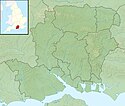
Położenie na mapie Hampshire Contains Ordnance Survey data © Crown copyright and database right, CC BY-SA 3.0 | |
 | |
Portsea (ang. Portsea Island) – wyspa u południowego wybrzeża Anglii, w hrabstwie Hampshire, w granicach administracyjnych miasta Portsmouth[1].
Wyspa ma powierzchnię 24,54 km²[2] i jest niemal całkowicie zabudowana. Znajduje się na niej większa część miasta Portsmouth, w tym jego historyczne centrum i port. Od stałego lądu wyspę oddziela wąska cieśnina Ports Creek. Na południe od wyspy znajduje się cieśnina Solent, a dalej kanał La Manche, na zachód – zatoka Portsmouth Harbour, a na wschód – zatoka Langstone Harbour[3][1].
Wyspa ma stałe połączenie drogowe (m.in. autostrada M275) i kolejowe ze stałym lądem, a także połączenia promowe z miastem Gosport na zachodzie, wyspą Hayling na wschodzie oraz, poprzez Solent, z wyspą Wight[1].
Przypisy
- ↑ a b c Mapa OS Explorer OL3, Ordnance Survey (ang.).
- ↑ Britain’s largest islands (ang.). Ordnance Survey Blog, 2018-06-28. [dostęp 2018-08-22].
- ↑ Alan King, Portsmouth City Libraries, The Portsmouth Encyclopedia: A History of Places and People in Portsmouth, with an Index to Streets, 2011, s. 260 [dostęp 2018-10-21] (ang.).
Media użyte na tej stronie
Flag of England. Saint George's cross (a red cross on a white background), used as the Flag of England, the Italian city of Genoa and various other places.
Autor: LA(PHOT) Paul A'Barrow., Licencja: OGL v1.0
An aerial photograph of Portsmouth Dockyard, which was taken as part of a Photex, it was taken from 2,000 feet.
The Photex was conducted for 849 NAS based at RNAS Culdrose, by a Lynx MK3 from 815 NAS based at RNAS Yeovilton, testing a new radar system that will detect buildings and ships within the dockyard area.
- Organization: Royal Navy
- Object Name: RN005
- Category: MOD
- Supplemental Categories: Equipment, Locations, Naval Bases, Portsmouth
- Keywords: Photex, Dockyard, Portsmouth, HMS Excellent, Aerial, HM Naval Base, Sea
- Country: UK
Contains Ordnance Survey data © Crown copyright and database right, CC BY-SA 3.0
Relief map of Hampshire, UK.
Equirectangular map projection on WGS 84 datum, with N/S stretched 155%
Geographic limits:
- West: 2.01W
- East: 0.68W
- North: 51.41N
- South: 50.68N
Autor: Alexrk2, Licencja: CC BY-SA 3.0
Location map of the United Kingdom
Autor: Nilfanion, Licencja: CC BY-SA 3.0
Relief map of England, UK.
Equirectangular map projection on WGS 84 datum, with N/S stretched 170%
Geographic limits:
- West: 6.75W
- East: 2.0E
- North: 56.0N
- South: 49.75N
Locator map of Portsea Island, Hampshire, between Portsmouth Harbour and Langstone Harbour


