Portsmouth
 Historyczna część miasta Portsmouth | |||||
| |||||
| Państwo | |||||
|---|---|---|---|---|---|
| Kraj | |||||
| Region | |||||
| Hrabstwo ceremonialne | |||||
| Unitary authority | Portsmouth | ||||
| Powierzchnia | 40,25 (dystrykt) km² | ||||
| Populacja (2001) • liczba ludności • gęstość |
| ||||
| Nr kierunkowy | 023 | ||||
| Tablice rejestracyjne | Portsmouth | ||||
Położenie na mapie Hampshire Contains Ordnance Survey data © Crown copyright and database right, CC BY-SA 3.0 | |||||
Położenie na mapie Wielkiej Brytanii (c) Karte: NordNordWest, Lizenz: Creative Commons by-sa-3.0 de | |||||
| Strona internetowa | |||||
| Portal | |||||
Portsmouth – miasto i dystrykt (unitary authority)[2] na południowym wybrzeżu Anglii w hrabstwie ceremonialnym Hampshire. Portsmouth znajduje się w odległości 103 km na południowy zachód od Londynu oraz 31 km na wschód od miasta Southampton. W 2001 roku miasto liczyło 187 056 mieszkańców[2]. W 2011 roku dystrykt liczył 205 056 mieszkańców[3].
Portsmouth, niegdyś ważny port marynarki wojennej, jest wielką atrakcją dla miłośników historii morskiej Wielkiej Brytanii. Jednym z najciekawszych miejsc jest stara stocznia (Portsmouth Historic Dockyard), w której można obejrzeć kadłub „Mary Rose” – słynnego flagowego okrętu Henryka VIII, oraz okręt liniowy HMS Victory – na którego pokładzie zginął admirał Horatio Nelson. Port aktualnie pełni także funkcję bazy Królewskiej Marynarki Wojennej. Kolejnym wartym uwagi miejscem jest Charles Dickens Museum – dom, w którym w 1812 r. urodził się pisarz Charles Dickens. W mieście znajduje się również Spinnaker Tower, która jest dumą architektoniczną miasta i odwiedza ją wielu turystów.
Większość miasta Portsmouth leży na wyspie Portsea, przy połączeniu cieśniny Solent z kanałem La Manche. Portsmouth jest rozwijającym się ekonomicznie miastem, ma w nim siedziby wiele międzynarodowych firm, między innymi IBM, BAE Systems i EADS Astrium.
W mieście znajduje się uniwersytet, oraz klub sportowy Portsmouth F.C. Miasto oraz klub sportowy jest potocznie nazywane przez miejscowych Pompey.
W Portsmouth działała utworzona 30 października 1835 Gromada Ludu Polskiego Grudziąż, skupiająca byłych powstańców listopadowych, którzy po upadku powstania byli więzieni w twierdzy grudziądzkiej.
Dzielnice
- Baffins, Central Southsea, Charles Dickens, Copnor, Cosham, Drayton and Farlington, Eastney and Craneswater, Fratton, Hilsea, Milton, Nelson, Paulsgrove, Southsea (miasto), St. Jude i St. Thomas[4].
Klimat
| Sty | Lut | Mar | Kwi | Maj | Cze | Lip | Sie | Wrz | Paź | Lis | Gru | Rok |
|---|---|---|---|---|---|---|---|---|---|---|---|---|
| 9.5 | 9.0 | 8.6 | 9.8 | 11.4 | 13.5 | 15.3 | 16.8 | 17.3 | 16.2 | 14.4 | 11.8 | 12.8 |
Miasta partnerskie
 Duisburg, Niemcy
 Caen, Francja
 Hajfa, Izrael
 Maizuru, Japonia
 Portsmouth, Stany Zjednoczone
 Sydney, Australia
 Lakewood, Stany Zjednoczone
 Portsmouth, Stany Zjednoczone
 Zhuhai, Chiny
 Zhanjiang, Chiny
Przypisy
- ↑ The Guardian
- ↑ a b Collins Dictionary
- ↑ Neighbourhood Statistics. [dostęp 2017-02-21]. [zarchiwizowane z tego adresu (2016-03-04)].
- ↑ Ordnance Survey linked data
- ↑ Portsmouth average sea temperature - seatemperature.org
Linki zewnętrzne
Media użyte na tej stronie
(c) Karte: NordNordWest, Lizenz: Creative Commons by-sa-3.0 de
Location map of the United Kingdom
Flag of England. Saint George's cross (a red cross on a white background), used as the Flag of England, the Italian city of Genoa and various other places.
Flag of Israel. Shows a Magen David (“Shield of David”) between two stripes. The Shield of David is a traditional Jewish symbol. The stripes symbolize a Jewish prayer shawl (tallit).
The flag of Navassa Island is simply the United States flag. It does not have a "local" flag or "unofficial" flag; it is an uninhabited island. The version with a profile view was based on Flags of the World and as a fictional design has no status warranting a place on any Wiki. It was made up by a random person with no connection to the island, it has never flown on the island, and it has never received any sort of recognition or validation by any authority. The person quoted on that page has no authority to bestow a flag, "unofficial" or otherwise, on the island.
Contains Ordnance Survey data © Crown copyright and database right, CC BY-SA 3.0
Map of Hampshire, UK with Portsmouth highlighted.
Equirectangular map projection on WGS 84 datum, with N/S stretched 155%Contains Ordnance Survey data © Crown copyright and database right, CC BY-SA 3.0
Map of Hampshire, UK with the following information shown:
- Administrative borders
- Coastline, lakes and rivers
- Roads and railways
- Urban areas
Equirectangular map projection on WGS 84 datum, with N/S stretched 155%
Geographic limits:
- West: 2.01W
- East: 0.68W
- North: 51.41N
- South: 50.68N
Autor: Felipe Fidelis Tobias, Licencja: CC BY-SA 4.0
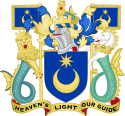
Coat of Arms of the City of Portsmouth
Autor: eNil from Portsmouth, UK, Licencja: CC BY 2.0
Old Portsmouth, View from Spinnaker Tower toward Portsmouth Cathedral and Southsea
Autor: JimmyGuano, Licencja: CC0
Flag of the City of Portsmouth, based on a banner of the city's arms. Own work, based on design here [1] and with evidence of status on page 65 of Bartram, Graham (2004). British Flags and Emblems. Tuckwell Press. ISBN 186232297X.


