Powiat (Czechy)

Powiat (cz. okres) – jednostka podziału administracyjnego II stopnia w Czechach. Jednostkami podrzędnymi są gminy (cz. obec), a nadrzędnymi kraje. Powiaty obecnie nie mają samorządu. Na przełomie 2002 i 2003 roku w ramach reformy administracyjnej zniesiono urzędy na szczeblu powiatowym. Pozostały one wyłącznie jednostkami statystycznymi i organizacyjnymi służby zdrowia, obwodami sądów, prokuratury, organów władzy rządowej, niektórych jednostek organizacyjnych policji, a w razie potrzeby również innych instytucji. Kompetencje urzędów powiatowych przejęły kraje i gminy z rozszerzoną działalnością. Przed reformą na czele powiatów stał přednosta wyznaczany i odwoływany przez rząd centralny. W latach 1990–2002 funkcjonowało 76 powiatów[1][2].
Lista powiatów
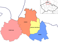
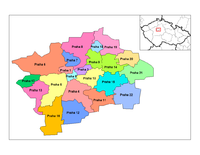
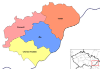
Lista powiatów na terytorium Czech z uwzględnieniem ludności, powierzchni, liczby gmin i kraju.
| Kraj | Powiat | Powierzchnia (w km²)[3] | Populacja (2018)[4] | Liczba gmin[5] |
|---|---|---|---|---|
| Kraj karlowarski (Karlovarský kraj) | Cheb | 1 046 | 91 563 | 40 |
| Karlowe Wary | 1 511 | 115 328 | 54 | |
| Sokolov | 754 | 88 795 | 38 | |
| Kraj środkowoczeski (Středočeský kraj) | Benešov | 1 475 | 97 972 | 114 |
| Beroun | 704 | 92 353 | 85 | |
| Kladno | 720 | 164 051 | 100 | |
| Kolín | 744 | 100 457 | 89 | |
| Kutná Hora | 917 | 75 189 | 88 | |
| Mielnik | 701 | 107 237 | 69 | |
| Mladá Boleslav | 1 023 | 127 776 | 120 | |
| Nymburk | 850 | 98 837 | 87 | |
| Praga-Wschód | 755 | 176 203 | 110 | |
| Praga-Zachód | 580 | 142 910 | 79 | |
| Przybram | 1 563 | 114 403 | 121 | |
| Rakovník | 896 | 55 407 | 83 | |
| Kraj hradecki (Královéhradecký kraj) | Hradec Králové | 892 | 163 520 | 104 |
| Jiczyn | 887 | 79 632 | 111 | |
| Náchod | 852 | 110 420 | 78 | |
| Rychnov nad Kněžnou | 982 | 78 979 | 80 | |
| Trutnov | 1 147 | 118 538 | 75 | |
| Kraj liberecki (Liberecký kraj) | Česká Lípa | 1 073 | 103 094 | 57 |
| Jablonec nad Nysą | 402 | 90 376 | 34 | |
| Liberec | 989 | 173 948 | 59 | |
| Semily | 699 | 73 882 | 65 | |
| Kraj morawsko-śląski (Moravskoslezský kraj) | Bruntál | 1 537 | 92 453 | 67 |
| Frydek-Mistek | 1 208 | 213 686 | 72 | |
| Karwina | 356 | 249 377 | 17 | |
| Nowy Jiczyn | 882 | 151 566 | 54 | |
| Opawa | 1 116 | 176 385 | 77 | |
| Ostrawa | 332 | 322 419 | 13 | |
| Kraj ołomuniecki (Olomoucký kraj) | Jesionik | 719 | 38 659 | 24 |
| Ołomuniec | 1 608 | 234 344 | 96 | |
| Przerów | 854 | 108 669 | 104 | |
| Prościejów | 777 | 130 515 | 97 | |
| Šumperk | 1 313 | 120 991 | 78 | |
| Kraj pardubicki (Pardubický kraj) | Chrudim | 993 | 104 158 | 108 |
| Pardubice | 880 | 172 022 | 112 | |
| Svitavy | 1 379 | 104 316 | 116 | |
| Uście nad Orlicą | 1 267 | 137 841 | 115 | |
| Kraj pilzneński (Plzeňský kraj) | Domažlice | 1 124 | 61 571 | 85 |
| Klatovy | 1 946 | 86 318 | 94 | |
| Pilzno | 261 | 189 747 | 15 | |
| Pilzno Południe | 997 | 62 736 | 90 | |
| Pilzno Północ | 1 287 | 78 561 | 98 | |
| Rokycany | 657 | 48 602 | 68 | |
| Tachov | 1 378 | 53 281 | 51 | |
| Praga (Hlavní město Praha) | Praga | 496 | 1 294 513 | 1 |
| Kraj południowoczeski (Jihočeský kraj) | Czeskie Budziejowice | 1 639 | 193 337 | 109 |
| Český Krumlov | 1 614 | 61 187 | 46 | |
| Jindřichův Hradec | 1 944 | 90 835 | 106 | |
| Písek | 1 127 | 71 067 | 75 | |
| Prachatice | 1 377 | 50 700 | 65 | |
| Strakonice | 1 032 | 70 760 | 112 | |
| Tabor | 1 326 | 102 310 | 110 | |
| Kraj południowomorawski (Jihomoravský kraj) | Blansko | 862 | 108 545 | 116 |
| Brzecław | 1 038 | 115 757 | 63 | |
| Brno (Brno-město) | 230 | 379 527 | 1 | |
| Brno (Brno-venkov) | 1 499 | 219 903 | 187 | |
| Hodonín | 1 099 | 154 353 | 82 | |
| Vyškov | 869 | 91 325 | 80 | |
| Znojmo | 1 590 | 113 797 | 144 | |
| Kraj ustecki (Ústecký kraj) | Chomutov | 936 | 124 347 | 44 |
| Děčín | 909 | 130 329 | 52 | |
| Litomierzyce | 1 032 | 119 553 | 105 | |
| Louny | 1 121 | 86 372 | 70 | |
| Most | 467 | 112 594 | 26 | |
| Cieplice | 469 | 128 387 | 34 | |
| Uście nad Łabą | 405 | 119 498 | 23 | |
| Kraj Wysoczyna (Vysočina) | Havlíčkův Brod | 1 265 | 94 486 | 120 |
| Igława | 1 199 | 112 930 | 123 | |
| Pelhřimov | 1 290 | 72 143 | 120 | |
| Třebíč | 1 463 | 111 426 | 167 | |
| Zdziar nad Sazawą | 1 579 | 117 931 | 174 | |
| Kraj zliński (Zlínský kraj) | Kromieryż | 796 | 105 670 | 79 |
| Uherské Hradiště | 991 | 142 434 | 78 | |
| Vsetín | 1 143 | 143 291 | 61 | |
| Zlin | 1 034 | 191 661 | 89 |
Przypisy
- ↑ Tadeusz Siwek (cs): Podziały wewnętrzne w Republice Czeskiej (pol.). rcin.org.pl. [dostęp 2018-09-15].
- ↑ Ryszard Kozioł: Czechy (pol.). bazhum.muzhp.pl. [dostęp 2018-09-15].
- ↑ Dane na rok 2017: Tab. 1 Vybrané ukazatele v okresech, v krajích (cz. • ang.). czso.cz. [dostęp 2018-09-20].
- ↑ Počet obyvatel v regionech soudržnosti, krajích a okresech České republiky k 1. 1. 2018 (cz. • ang.). czso.cz. [dostęp 2018-09-20].
- ↑ Počet obcí, částí obcí, základních sídelních jednotek a katastrálních území a úhrnné hodnoty podle krajů, okresů a správních obvodů obcí s rozšířenou působností (cz. • ang.). czso.cz. [dostęp 2018-09-20].
Media użyte na tej stronie
Flag of Hradec Králové Region
Flag of Karlovy Vary Region
Flag of Liberec Region
Flag of Moravian-Silesian Region
Flag of Olomouc Region
Flag of Pardubice Region
Flag of Plzeň Region
Flag of South Bohemian Region
Flag of South Moravian Region
Flag of Central Bohemian Region
Flag of Ústí nad Labem Region
Flag of Vysočina Region
Flag of Zlín Region
Map of the districts of Zlin region of the Czech Republic. Created by Rarelibra 15:31, 2 January 2007 (UTC) for public domain use, using MapInfo Professional v8.5 and various mapping resources.
Map of the districts of Pardubice region of the Czech Republic. Created by Rarelibra 15:14, 2 January 2007 (UTC) for public domain use, using MapInfo Professional v8.5 and various mapping resources.
Map of the districts of South Moravia region of the Czech Republic. Created by Rarelibra 15:29, 2 January 2007 (UTC) for public domain use, using MapInfo Professional v8.5 and various mapping resources.
Map of the districts of Olomouc region of the Czech Republic. Created by Rarelibra 15:13, 2 January 2007 (UTC) for public domain use, using MapInfo Professional v8.5 and various mapping resources.
Map of the districts of the Czech Republic showing former district borders before December 31, 2006. Created by Rarelibra 18:42, 29 December 2006 (UTC) for public domain use, using MapInfo Professional v8.5 and various mapping resources.
Map of the districts of Carlsbad region of the Czech Republic. Created by Rarelibra 15:06, 2 January 2007 (UTC) for public domain use, using MapInfo Professional v8.5 and various mapping resources.
Map of the districts of Plzen region of the Czech Republic. Created by Rarelibra 15:14, 2 January 2007 (UTC) for public domain use, using MapInfo Professional v8.5 and various mapping resources.
Autor: Jeśli zamierzać użyć tego zdjęcia poza projektami Wikimedia, będę wdzięczny za informację mailową. Więcej zdjęć możesz znaleźć w mojej galerii., Licencja: CC BY 3.0
Ústí nad Labem/Litoměřice district borders near the village of Kletečná, CZ
Map of the districts of Hradec Kralove region of the Czech Republic. Created by Rarelibra 15:08, 2 January 2007 (UTC) for public domain use, using MapInfo Professional v8.5 and various mapping resources.
Map of the districts of Vysocina region of the Czech Republic. Created by Rarelibra 15:30, 2 January 2007 (UTC) for public domain use, using MapInfo Professional v8.5 and various mapping resources.
Map of the districts of Central Bohemia region of the Czech Republic. Created by Rarelibra 15:07, 2 January 2007 (UTC) for public domain use, using MapInfo Professional v8.5 and various mapping resources.
Map of the districts of Usti nad Labem region of the Czech Republic. Created by Rarelibra 15:30, 2 January 2007 (UTC) for public domain use, using MapInfo Professional v8.5 and various mapping resources.
Map of the districts of Liberec region of the Czech Republic. Created by Rarelibra 15:12, 2 January 2007 (UTC) for public domain use, using MapInfo Professional v8.5 and various mapping resources.
Map of the districts of South Bohemia region of the Czech Republic. Created by Rarelibra 15:29, 2 January 2007 (UTC) for public domain use, using MapInfo Professional v8.5 and various mapping resources.
Map of the districts of Moravia-Silesia region of the Czech Republic. Created by Rarelibra 15:13, 2 January 2007 (UTC) for public domain use, using MapInfo Professional v8.5 and various mapping resources.


