Praga 20
| Dzielnica Pragi | |||||
| |||||
| Państwo | |||||
|---|---|---|---|---|---|
| Miasto | |||||
| Data założenia | 1990 | ||||
| Burmistrz | Ivan Liška | ||||
| Powierzchnia | 16,95 km² | ||||
| Populacja (2008) • liczba ludności |
| ||||
| • gęstość | 860 os./km² | ||||
| Kod pocztowy | 193 00 | ||||
Położenie na mapie Pragi | |||||
| 50°06′53″N 14°36′45″E/50,114722 14,612500 | |||||
| Strona internetowa | |||||
| Portal | |||||
Praga 20 – dzielnica Pragi rozciągająca się na wschód od centrum miasta, na wschód od Wełtawy.
Obszar dzielnicy wynosi 16,95 km² i jest zamieszkiwany przez 14 571 mieszkańców (2008).
Linki zewnętrzne
Media użyte na tej stronie
Prague coat of arms.
Autor: Zirland, Licencja: CC BY-SA 2.5
Flag of Horní Počernice (part of city Prague in Czechia)
Location map of municipal district and administrative district Prague 20
Prague coat of arms.
Autor: TFerenczy, Licencja: CC BY-SA 4.0
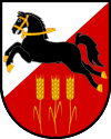
Coat of arms of Prague 20, a municipal district of Prague, Czechia
(c) I, Mirekk, CC BY 2.5
Prague, Horní Počernice, town hall of district Prague 20 (Czechia)


