Priaranza del Bierzo
| |||
 | |||
| |||
| Państwo | |||
| Wspólnota autonomiczna | Kastylia i León | ||
| Prowincja | León | ||
| Alkad | Jose Manuel Blanco Gomez↗ | ||
| Powierzchnia | 33,69[1] km² | ||
| Populacja (2011) • liczba ludności • gęstość | 828[1] 24,58 os./km² | ||
| Kod pocztowy | 24448 | ||
| Tablice rejestracyjne | LE | ||
Położenie na mapie Kastylii i Leónu (c) Miguillen, CC BY-SA 3.0 | |||
| Strona internetowa | |||
| Portal | |||
Priaranza del Bierzo – gmina w Hiszpanii, w prowincji León, w Kastylii i León, o powierzchni 33,69[1] km². W 2011 roku gmina liczyła 828[1] mieszkańców.
Przypisy
- ↑ a b c d Ministerio de Hacienda y Administraciones Públicas: Datos del registro de Entidades Locales (hiszp.). [dostęp 2013-06-16].
Media użyte na tej stronie
(c) Miguillen, CC BY-SA 3.0
Location map of Castile and León
Autor: NordNordWest, Licencja: CC BY-SA 3.0
Location map of Spain
Equirectangular projection, N/S stretching 130 %. Geographic limits of the map:
- N: 44.4° N
- S: 34.7° N
- W: 9.9° W
- E: 4.8° E
Autor: Pedro A. Gracia Fajardo, escudo de Manual de Imagen Institucional de la Administración General del Estado, Licencja: CC0
Flaga Hiszpanii
Flag of the province of León (Spain). See Heraldry of León (Spanish) for details.
Autor: SanchoPanzaXXI(Taller de Heráldica y Vexilología in the Spanish Wikipedia
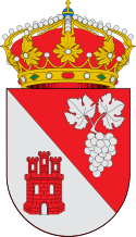
Escudo de Priaranza del Bierzo, en León (España): Escudo tronchado. 1º de gules, un racimo de uvas de plata; 2º de plata, un castillo de gules. Al timbre corona real cerrada.Boletín Oficial de Castilla y León, nº 81, 30/4/1997.
Autor: FCPB, Licencja: CC-BY-SA-3.0
Talla de un caballero Templario en el tronco de un árbol en Santalla del Bierzo


