Prijedor
| |||||
 | |||||
| Państwo | |||||
| Część składowa | |||||
| Miasto | Prijedor | ||||
| Burmistrz | Marko Pavić | ||||
| Powierzchnia | 833 km² | ||||
| Populacja (2013) • liczba ludności | 27 970[1] | ||||
| Nr kierunkowy | (+387) 052 | ||||
| Kod pocztowy | 79000 | ||||
| Strona internetowa | |||||
Prijedor (cyr. Приједор) – miasto w Bośni i Hercegowinie, w Republice Serbskiej, siedziba miasta Prijedor. Jest położone nad rzeką Sana, na północny zachód od Banja Luki. W 2013 roku liczyło 27 970 mieszkańców[1].
W mieście rozwinął się przemysł spożywczy, drzewny oraz odzieżowy[2].
Miasta partnerskie
 Manisa, Turcja
 Pančevo, Serbia
 Kikinda, Serbia
 Neapolis, Grecja
 Gmina Sund, Norwegia
 Trydent, Włochy
 Bovec, Słowenia
 Novo Mesto, Słowenia
 Demir Hisar, Macedonia Północna
Przypisy
- ↑ a b Резултати Пописа 2013, Градови, општине, насељена мјеста (serb.). Републички завод за статистику. [dostęp 2019-09-13].
- ↑ Prijedor, [w:] Encyklopedia PWN [online] [dostęp 2021-08-06].
Media użyte na tej stronie
Autor: NordNordWest, Licencja: CC BY-SA 3.0
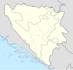
Location map of Bosnia and Herzegovina
Flag of the Serb Republic (not to be confused with the Republic of Serbia).
Autor: Natalino7 at en.wikipedia, Licencja: GFDL
Main street buildings in Prijedor, Bosnia-Hercegovina
This is the official coat of arms of city of Prijedor since 05/08/2013 . Soon or later they want to change the sun symbol into the memorial of mrakovica.
Autor: Banovic, Licencja: CC-BY-SA-3.0
Building on the squer between the market place at Pecani and the urban park behind the photographer. This building was maded in the 90´s by the Mrakovica company.


