Prowincja Przylądkowa Wschodnia
| Prowincja | |||
 | |||
| |||
| Państwo | |||
|---|---|---|---|
| Siedziba | |||
| Kod ISO 3166-2 |
| ||
| Powierzchnia | 169 580 km² | ||
| Populacja (2011) • liczba ludności |
| ||
| • gęstość | 37,96 os./km² | ||
| Plan | |||
 | |||
Położenie na mapie | |||
| Strona internetowa | |||
Prowincja Przylądkowa Wschodnia (ang. Eastern Cape, afr. Oos-Kaap) – prowincja RPA. Jej stolicą jest Bhisho. Jednym z lepiej znanych miast w tamtych okolicach jest Grahamstown, ponieważ znajduje się tam jedna z najstarszych szkół w RPA – St Andrews College.
Podział administracyjny
Prowincja Przylądkowa Wschodnia dzieli się na 2 obszary metropolitalne oraz 6 dystryktów, które z kolei dzielą się na 37 gmin.
- Nelson Mandela Bay
- Buffalo City
- Sarah Baartman
- Camdeboo
- Blue Crane Route
- Ikwezi
- Makana
- Ndlambe
- Sunday's River Valley
- Baviaans
- Kouga
- Kou-Kamma
- Amatole
- Mbhashe
- Mnquma
- Great Kei
- Amahlathi
- Ngqushwa
- Nkonkobe
- Nxuba
- Chris Hani
- Inxuba Yethemba
- Tsolwana
- Inkwanca
- Lukhanji
- Intsika Yethu
- Emalahleni
- Engcobo
- Sakhisizwe
- Joe Gqabi
- Elundini
- Senqu
- Maletswai
- Gariep
- O.R. Tambo
- Ngquza Hill
- Port St Johns
- Nyandeni
- Mhlontlo
- King Sabata Dalindyebo
- Alfred Nzo
Media użyte na tej stronie
Autor: TUBS
Location of province xy (see filename) in South Africa.
Autor: Htonl, Licencja: CC BY-SA 4.0
Map of municipal boundaries in the Eastern Cape, as they will be after the municipal elections of 18 May 2011, with district and metropolitan municipalities named.
Autor: Htonl, Licencja: CC BY-SA 3.0
Map of the municipalities in the Eastern Cape province of South Africa, with all municipalities named and district municipalities shaded different colours.
Autor: NJR ZA, Licencja: CC BY-SA 3.0
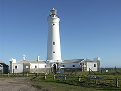
Seal Point Lighthouse, Cape St. Francis, Eastern Cape, South Africa.


