Pruines
| miejscowość i gmina | |
 Kościół w Pruines | |
| Państwo | |
|---|---|
| Region | |
| Departament | |
| Okręg | |
| Kod INSEE | 12193 |
| Powierzchnia | 18,36 km² |
| Populacja (2013) • liczba ludności |
|
| Kod pocztowy | 12320 |
| Portal | |
Pruines – miejscowość i gmina we Francji, w regionie Oksytania, w departamencie Aveyron[1]. W 2013 roku populacja Pruines wynosiła 314 mieszkańców[2]. Na terenie gminy, na południowy wschód od wzniesienia Pic de Kaymard, swoje źródła ma rzeka Duzou[3]. Ponadto przez gminę przepływa Dourdou de Conques[4].
Przypisy
- ↑ Atlas Routier France 2014. Michelin, s. 262. ISBN 978-2-06-719261-4. (fr.)
- ↑ Populations légales 2013 - 12124-Lassouts (fr.). INSEE. [dostęp 2016-11-14].
- ↑ Fiche cours d'eau – Le Duzou (O8070540) (fr.). SANDRE. [dostęp 2016-03-30].
- ↑ Fiche cours d'eau – (O80-0400) (fr.). SANDRE. [dostęp 2016-11-14].
Media użyte na tej stronie
Autor: Flappiefh, Licencja: CC BY-SA 4.0
Blank administrative map of the department of Aveyron, France, for geo-location purpose.
Autor: Superbenjamin, Licencja: CC BY-SA 4.0
Blank administrative map of France for geo-location purpose, with regions and departements distinguished. Approximate scale : 1:3,000,000
Autor: Flappiefh, Licencja: CC BY-SA 4.0
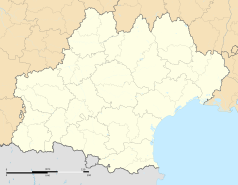
Carte administrative vierge de la région Languedoc-Roussillon-Midi-Pyrénées, France, destinée à la géolocalisation.
Autor: Krzysztof Golik, Licencja: CC BY-SA 4.0
Saint Hilary Church of Pruines, Aveyron, France


