Punkaharju
 | |||
| |||
| Państwo | |||
|---|---|---|---|
| Region | |||
| Powierzchnia | 748,12 km² | ||
| Populacja (2012) • liczba ludności |
| ||
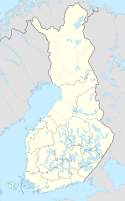
Położenie na mapie Finlandii (c) Karte: NordNordWest, Lizenz: Creative Commons by-sa-3.0 de | |||
| Strona internetowa | |||
| Portal | |||
Punkaharju – gmina w Finlandii, położona w południowo-wschodniej części kraju, należąca do regionu Etelä-Savo.
Przypisy
- ↑ Kuntien asukasluvut aakkosjärjestyksessä. Väestörekisterikeskus. [dostęp 2020-06-01]. (fiń. • szw.).
Media użyte na tej stronie
Finland adm location map.svg
(c) Karte: NordNordWest, Lizenz: Creative Commons by-sa-3.0 de
Location map of Finland
(c) Karte: NordNordWest, Lizenz: Creative Commons by-sa-3.0 de
Location map of Finland
Flag of Finland.svg
Flaga Finlandii
Flaga Finlandii
Etelä-Savo.vaakuna.svg
Coat of arms of Southern Savonia
Coat of arms of Southern Savonia
Punkaharju.vaakuna.svg
Azure a fess Or fir-twigged and wavy, in chief a crown of the same.
Azure a fess Or fir-twigged and wavy, in chief a crown of the same.
Punkaharju landscape.JPG
One of the best known spots of the Punkaharju ridge on the connecting road 4792 (former highway 14) in Punkaharju, Finland.
One of the best known spots of the Punkaharju ridge on the connecting road 4792 (former highway 14) in Punkaharju, Finland.


