Queen Victoria Street
| ||
| City of London | ||
(c) Whatlep, CC BY-SA 2.0 Queen Victoria Street, 2009 | ||
| Państwo | ||
| Miejscowość | Londyn | |
| Długość | 1100 m | |
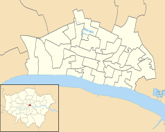
Położenie na mapie City of London Contains Ordnance Survey data © Crown copyright and database right, CC BY-SA 3.0 | ||
Położenie na mapie Wielkiej Brytanii (c) Karte: NordNordWest, Lizenz: Creative Commons by-sa-3.0 de | ||
Położenie na mapie Wielkiego Londynu Contains Ordnance Survey data © Crown copyright and database right, CC BY-SA 3.0 | ||
| 51,512°N 0,100°W/51,512000 -0,099930 | ||
Queen Victoria Street – ulica w centralnym Londynie (Anglia) w City of London, łącząca New Bridge Street z Mansion House Street. Została nazwana na cześć królowej Wiktorii panującej w latach 1837-1901.
Ulica została otwarta w 1861 roku, a jej budowa pochłonęła milion funtów. Stanowi wizytówkę City of London[1].
Najbliższymi stacjami metra są Blackfriars, Mansion House i Bank.
Znaczące miejsca
- St. Andrew-by-the-Wardrobe - kościół anglikański,
- Monetary Authority of Singapore - władze monetarne Singapuru,
- siedziba główna Armii Zbawienia,
- City of London School
- The Bank of New York Mellon
- College of Arms
- Millennium Bridge
Przypisy
- ↑ Mary Irene Cathcart Borer: The City of London : a history. New York : McKay, 1978.
Media użyte na tej stronie
(c) Karte: NordNordWest, Lizenz: Creative Commons by-sa-3.0 de
Location map of the United Kingdom
Contains Ordnance Survey data © Crown copyright and database right, CC BY-SA 3.0
Map of Greater London, UK with the following information shown:
- Administrative borders
- Coastline, lakes and rivers
- Roads and railways
- Urban areas
The data includes both primary routes and railway lines.
Equirectangular map projection on WGS 84 datum, with N/S stretched 160%
Geographic limits:
- West: 0.57W
- East: 0.37E
- North: 51.72N
- South: 51.25N
Crossroads with a major road ahead.
(c) Whatlep, CC BY-SA 2.0
Queen Victoria Street, City of London
Contains Ordnance Survey data © Crown copyright and database right, CC BY-SA 3.0
Blank map of the City of London, showing electoral wards.
Equirectangular map projection on WGS 84 datum, with N/S stretched 160%
Geographic limits:
- West: 0.12W
- East: 0.07W
- North: 51.525N
- South: 51.5N


