Rhosneigr
(c) Eric Jones, CC BY-SA 2.0 | |
| Państwo | |
|---|---|
| Księstwo | |
| Hrabstwo | |
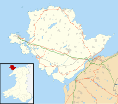
Położenie na mapie Anglesey Contains Ordnance Survey data © Crown copyright and database right, CC BY-SA 3.0 | |
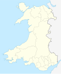
Położenie na mapie Wielkiej Brytanii (c) Karte: NordNordWest, Lizenz: Creative Commons by-sa-3.0 de | |
| Strona internetowa | |
| Portal | |
Rhosneigr – wieś w północnej Walii w hrabstwie Anglesey, położona na południowo-zachodnim wybrzeżu wyspy Anglesey, nad zatoką Caernarvon, ok. 10 km na południowy wschód od Holyhead. Liczba ludności, według spisu z 2011 roku, wynosi 1008 osób.
Z zegara w centrum Rhosneigr widać Holyhead Mountain.
Media użyte na tej stronie
Contains Ordnance Survey data © Crown copyright and database right, CC BY-SA 3.0
Blank map of the Anglesey, UK with the following information shown:
- Administrative borders
- Coastline, lakes and rivers
- Roads and railways
- Urban areas
Equirectangular map projection on WGS 84 datum, with N/S stretched 165%
Geographic limits:
- West: 4.75W
- East: 4.00W
- North: 53.45N
- South: 53.05N
(c) Karte: NordNordWest, Lizenz: Creative Commons by-sa-3.0 de
Location map of the United Kingdom
Autor: NordNordWest, Licencja: CC BY-SA 3.0
Location map of Wales, United Kingdom
(c) Eric Jones, CC BY-SA 2.0
Houses above a rocky shore where the High Street and Lon Traeth Llydan meet


