Richardson
(c) Michael Barera, CC BY-SA 4.0 Plac w pobliżu stacji tramwajowej Galatin Park. | |||
| |||
| Państwo | |||
|---|---|---|---|
| Stan | |||
| Zarządzający | Paul Voelker↗ | ||
| Powierzchnia | 74,2 km² | ||
| Wysokość | 192 m n.p.m. | ||
| Populacja (2020) • liczba ludności • gęstość |
| ||
| Kod pocztowy | 75080–75082 | ||
| Strona internetowa | |||
| Portal | |||
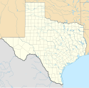
Richardson (czyt. Riczardson) – miasto w amerykańskich hrabstwach Dallas i Collin, w stanie Teksas. Jest częścią obszaru metropolitalnego Dallas–Fort Worth. Według spisu z 2020 roku liczy 119,5 tys. mieszkańców[1].
Jest siedzibą University of Texas at Dallas, oraz technologicznego centrum biznesowego Telecom Corridor, z dużą koncentracją firm telekomunikacyjnych. Na obszarze Richardson swoją działalność prowadzi ponad 5700 firm, w tym 600 firm technologicznych i są to m.in.: AT&T, Verizon, Samsung, MetroPCS i Texas Instruments[2]. Największą bazę zatrudnienia w Richardson zapewnia branża ubezpieczeniowa, z biurami takich firm, jak: State Farm, czy GEICO[3].
Richardson to także centrum kulturalne, zwłaszcza od czasu otwarcia ogromnego Centrum Charlesa W. Eisemanna. Goście mogą korzystać z 64 km szlaków pieszych i rowerowych, oraz 37 km chodników w leśnym rezerwacie Galatyn i rezerwacie przyrody Spring Creek[4].
Zobacz też
- „Jeremy” – ballada rockowa luźno inspirowana zdarzeniem w mieście z 1991 roku
Przypisy
- ↑ U.S. Census Bureau QuickFacts: Richardson city, Texas, www.census.gov [dostęp 2022-01-03] (ang.).
- ↑ IASP global directory of science & technology park & innovation district – IASP, www.iasp.ws [dostęp 2022-01-03].
- ↑ Richardson Economic Development Partnership, Major Employers, Richardson Economic Development Partnership [dostęp 2022-01-03] (ang.).
- ↑ 16 Best Things to Do in Richardson, Texas, VacationIdea [dostęp 2022-01-03] (ang.).
Linki zewnętrzne
Media użyte na tej stronie
Autor: Uwe Dedering, Licencja: CC BY-SA 3.0
Location map of the USA (without Hawaii and Alaska).
EquiDistantConicProjection:
Central parallel:
* N: 37.0° N
Central meridian:
* E: 96.0° W
Standard parallels:
* 1: 32.0° N
* 2: 42.0° N
Made with Natural Earth. Free vector and raster map data @ naturalearthdata.com.
Formulas for x and y:
x = 50.0 + 124.03149777329222 * ((1.9694462586094064-({{{2}}}* pi / 180))
      * sin(0.6010514667026994 * ({{{3}}} + 96) * pi / 180))
y = 50.0 + 1.6155950752393982 * 124.03149777329222 * 0.02613325650382181
      - 1.6155950752393982  * 124.03149777329222 *
     (1.3236744353715044  - (1.9694462586094064-({{{2}}}* pi / 180))
      * cos(0.6010514667026994 * ({{{3}}} + 96) * pi / 180))
The flag of Navassa Island is simply the United States flag. It does not have a "local" flag or "unofficial" flag; it is an uninhabited island. The version with a profile view was based on Flags of the World and as a fictional design has no status warranting a place on any Wiki. It was made up by a random person with no connection to the island, it has never flown on the island, and it has never received any sort of recognition or validation by any authority. The person quoted on that page has no authority to bestow a flag, "unofficial" or otherwise, on the island.
Autor: Alexrk, Licencja: CC BY 3.0
Ta mapa została stworzona za pomocą GeoTools.
Autor:
Loadmaster (David R. Tribble)

|
This image was made by Loadmaster (David R. Tribble)
Email the author: Also see my personal gallery at Google Photos |
Charles W. Eisemann Center for Performing Arts in Richardson, Texas
(c) Michael Barera, CC BY-SA 4.0
A plaza in Richardson, Texas (United States).
The official city flag of Richardson, Texas, consisting of a large scripted letter "R" across most of the flag, two silver bands near the bottom, and a small city logo in the lower fly.


