Ringway
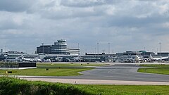
 Port lotniczy Manchester w 2012 | |
| Państwo | |
|---|---|
| Kraj | |
| Hrabstwo ceremonialne | |
| Unitary authority | Manchester |
| Populacja (2011) • liczba ludności |
|
| Nr kierunkowy | 0161 |
| Kod pocztowy | WA15 |
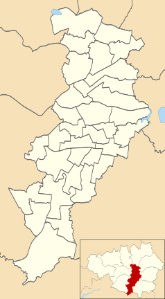
Położenie na mapie Manchesteru Contains Ordnance Survey data © Crown copyright and database right, CC BY-SA 3.0 | |
Położenie na mapie Wielkiej Brytanii (c) Karte: NordNordWest, Lizenz: Creative Commons by-sa-3.0 de | |
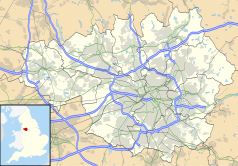
Położenie na mapie Wielkiego Manchesteru Contains Ordnance Survey data © Crown copyright and database right, CC BY-SA 3.0 | |
| Portal | |
Ringway lub Ringey[2] – osada i civil parish w Anglii, w hrabstwie ceremonialnym Wielki Manchester, w dystrykcie (unitary authority) City of Manchester[3]. Leży 13 km na południe od centrum miasta Manchester[4]. W 2011 roku civil parish liczyła 103 mieszkańców[1].
W osadzie znajduje się port lotniczy Manchester, otwarty w 1938 roku, początkowo nazwany Ringway Airport. Podczas II wojny światowej istniała tam baza lotnictwa wojskowego RAF Ringway. W 1974 roku Ringway zostało włączone w obręb City of Manchester jako civil parish.
Przypisy
- ↑ a b Populacja według spisu ludności 2001. Dane dostępne ze strony https://web.archive.org/web/20151122145431/http://www.neighbourhood.statistics.gov.uk/dissemination/LeadKeyFigures.do?a=7&b=11127944&c=Ringway&d=16&e=62&g=6343393&i=1001x1003x1032x1004&m=0&r=1&s=1448131669953&enc=1
- ↑ Vision of Britain
- ↑ Ordnance Survey linked data
- ↑ Ringway na mapie (ang.). getamap.ordnancesurvey.co.uk. [dostęp 2010-10-06].
Media użyte na tej stronie
(c) Karte: NordNordWest, Lizenz: Creative Commons by-sa-3.0 de
Location map of the United Kingdom
Flag of England. Saint George's cross (a red cross on a white background), used as the Flag of England, the Italian city of Genoa and various other places.
Contains Ordnance Survey data © Crown copyright and database right, CC BY-SA 3.0
Map of Manchester, Greater Manchester, UK with electoral wards shown.
Equirectangular map projection on WGS 84 datum, with N/S stretched 165%
Geographic limits:
- West: 2.33W
- East: 2.13W
- North: 53.55N
- South: 53.33N
Contains Ordnance Survey data © Crown copyright and database right, CC BY-SA 3.0
Map of Greater Manchester, UK with the following information shown:
- Administrative borders
- Coastline, lakes and rivers
- Roads and railways
- Urban areas
The data includes both primary routes and railway lines.
Equirectangular map projection on WGS 84 datum, with N/S stretched 165%
Geographic limits:
- West: 2.80W
- East: 1.90W
- North: 53.70N
- South: 53.32N
Autor: Craig Sunter from Manchester, UK, Licencja: CC BY 2.0
Manchester Airport view


