Roding Valley
 Budynek stacji Roding Valley, 2009 | |
| Państwo | |
|---|---|
| Miejscowość | Londyn |
| Dzielnica | Buckhurst Hill |
| Data otwarcia | 1948 |
| Liczba peronów | 2 |
| Central Line | |
| Poprzednia stacja | Chigwell |
| Następna stacja | Woodford |
Położenie na mapie hrabstwa Essex  Contains Ordnance Survey data © Crown copyright and database right, CC BY-SA 3.0 | |
Położenie na mapie Wielkiej Brytanii  (c) Karte: NordNordWest, Lizenz: Creative Commons by-sa-3.0 de | |
Położenie na mapie Anglii  | |
| Portal | |
Roding Valley – stacja londyńskiego metra położona na trasie Central Line pomiędzy stacjami Chigwell a Woodford. Znajduje się w Buckhurst Hill w dystrykcie Epping Forest, w czwartej strefie biletowej[1].
W latach 2008-2010 stacja obsługiwała około 201 tysięcy pasażerów rocznie, tym samym jest najmniej używaną stacją w całej sieci metra londyńskiego[2].
Połączenia
Stacja obsługiwana jest przez autobusy linii 549.
Galeria
Widok na wschód

Widok na zachód
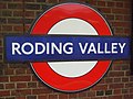
Symbol stacji
Przypisy
- ↑ Tube stations - Roding Valley. Transport for London. [dostęp 2012-01-10].
- ↑ Customer metrics: entries and exits (ang.). Transport For London. [dostęp 2012-01-10].
| Linia główna | |
|---|---|
| Odgałęzienie West Ruislip | |
| Odgałęzienie Ealing Broadway | |
| Odgałęzienie Woodford | |
| Odgałęzienie Epping |
![]()
Media użyte na tej stronie
United Kingdom adm location map.svg
(c) Karte: NordNordWest, Lizenz: Creative Commons by-sa-3.0 de
Location map of the United Kingdom
(c) Karte: NordNordWest, Lizenz: Creative Commons by-sa-3.0 de
Location map of the United Kingdom


Roding Valley stn look east.JPG
Autor: Sunil060902, Licencja: CC BY-SA 3.0
Roding Valley tube station looking eastwards to Chigwell (though operationally we are looking westbound, with trains running through Hainault towards Central London)
Autor: Sunil060902, Licencja: CC BY-SA 3.0
Roding Valley tube station looking eastwards to Chigwell (though operationally we are looking westbound, with trains running through Hainault towards Central London)
Essex UK location map.svg
Contains Ordnance Survey data © Crown copyright and database right, CC BY-SA 3.0
Contains Ordnance Survey data © Crown copyright and database right, CC BY-SA 3.0
Map of Essex, UK with the following information shown:
- Administrative borders
- Coastline, lakes and rivers
- Roads and railways
- Urban areas
Equirectangular map projection on WGS 84 datum, with N/S stretched 160%
Geographic limits:
- West: 0.06W
- East: 1.32E
- North: 52.11N
- South: 51.42N

Roding Valley stn roundel.JPG
Autor: Sunil060902, Licencja: CC BY-SA 3.0
Roding Valley tube station platform roundel
Autor: Sunil060902, Licencja: CC BY-SA 3.0
Roding Valley tube station platform roundel

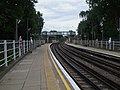
Roding Valley stn west.JPG
Autor: Sunil060902, Licencja: CC-BY-SA-3.0
Roding Valley tube station looking west (actually operationally 'eastbound' due to the loop line from Hainault)
Autor: Sunil060902, Licencja: CC-BY-SA-3.0
Roding Valley tube station looking west (actually operationally 'eastbound' due to the loop line from Hainault)
Roding Valley stn building.JPG
Autor: Sunil060902, Licencja: CC BY-SA 3.0
Roding Valley tube station main building on the northern side
Autor: Sunil060902, Licencja: CC BY-SA 3.0
Roding Valley tube station main building on the northern side