Rohatec
| gmina | |||||
 | |||||
| Państwo | |||||
|---|---|---|---|---|---|
| Kraj | |||||
| Powiat | |||||
| Kraina | |||||
| Powierzchnia | 17,45 km² | ||||
| Populacja (2014) • liczba ludności |
| ||||
| Kod pocztowy | 696 01 | ||||
| Szczegółowy podział administracyjny | |||||
| Liczba obrębów ewidencyjnych | 1 | ||||
| Liczba części gminy | 1 | ||||
| Liczba gmin katastralnych | 1 | ||||
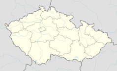
Położenie na mapie Czech (c) Karte: NordNordWest, Lizenz: Creative Commons by-sa-3.0 de | |||||
| Strona internetowa | |||||
| Portal | |||||
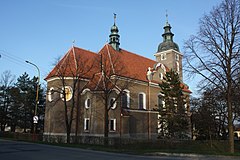
Rohatec – gmina w Czechach, w powiecie Hodonín, w kraju południowomorawskim. Według danych z dnia 1 stycznia 2014 liczyła 3 571 mieszkańców[1].
Przypisy
- ↑ a b Počty obyvatel v obcích k 1. 1. 2013. www.mvcr.cz. [dostęp 2014-08-23]. (cz.).
Media użyte na tej stronie
(c) Karte: NordNordWest, Lizenz: Creative Commons by-sa-3.0 de
Location map of the Czech Republic
Flag of South Moravian Region
Autor:

|
This image is a work by Mercy.
When reusing, please credit me as: Mercy from Wikimedia Commons.
Do not copy this image illegally by ignoring the terms of the license below, as it is not in the public domain. If you would like special permission to use, license, or purchase the image please contact me to negotiate terms. More of my work can be found in my personal gallery. |
This photograph was taken within the scope of the 'Czech Municipalities Photographs' grant.
Autor: Afil, Licencja: CC BY-SA 3.0
Location map of South Moravian Region of the Czech Republic


