Ruiselede
| |||||
| Państwo | |||||
|---|---|---|---|---|---|
| Prowincja | Flandria Zachodnia | ||||
| Burmistrz | Greet De Roo | ||||
| Powierzchnia | 30,20 km² | ||||
| Populacja (2006) • liczba ludności • gęstość |
| ||||
| Nr kierunkowy | 051 | ||||
| Kod pocztowy | 8755 | ||||
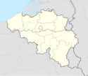
Położenie na mapie Belgii (c) Karte: NordNordWest, Lizenz: Creative Commons by-sa-3.0 de | |||||
| Strona internetowa | |||||
Ruiselede – miejscowość i gmina w Belgii w prowincji Flandria Zachodnia.
- Ludność (2006): 5113
- Powierzchnia: 30,2 km²
Miasta partnerskie
Media użyte na tej stronie
Belgium West Flanders location map.svg
Autor: Milenioscuro, Licencja: CC BY-SA 3.0
Location map of West Flanders province, Belgium
Autor: Milenioscuro, Licencja: CC BY-SA 3.0
Location map of West Flanders province, Belgium
Belgium adm location map.svg
(c) Karte: NordNordWest, Lizenz: Creative Commons by-sa-3.0 de
Location map of Belgium
(c) Karte: NordNordWest, Lizenz: Creative Commons by-sa-3.0 de
Location map of Belgium
Ruiselede vlag.svg
Vlag van Ruiselede
Vlag van Ruiselede
Ruiselede - Markt 1.jpg
(c) I, LimoWreck, CC BY 2.5
Markt market square in Ruiselede, with town hall and tower of the church of Our Lady. Ruiselede, West Flanders, Belgium.
(c) I, LimoWreck, CC BY 2.5
Markt market square in Ruiselede, with town hall and tower of the church of Our Lady. Ruiselede, West Flanders, Belgium.
Ruiselede wapen.svg
Wapenschild van Ruiselede
Wapenschild van Ruiselede


