Rzeki w Stanach Zjednoczonych
Lista zawiera główne biegi 38 rzek w Stanach Zjednoczonych, które mierzą co najmniej 800 km długości.
Tabela
Dodatkowe oznaczenia w tabeli |
Głównym źródłem danych do tabeli jest Rivers of North America Benke'go i Cushinga. Sprzeczne dane z innych źródeł, jeśli różnica była większa niż 10% danej wielkości, podano w informacji dodatkowej[ak].
Uwagi
- ↑ a b c Koordynaty ujścia oraz źródła pochodzą z Geographic Names Information System (United States Geological Survey) lub z Canadian Geographical Names Data Base z wyjątkiem Rzeki Kolorado, której współrzędne pozyskano z Google Earth.
- ↑ a b o ile nie zaznaczono inaczej
- ↑ Spośród czego 28 000 km2, ok. 2% powierzchni zlewni znajduje się w Kanadzie[6][7].
- ↑ Kammerer: 76 200 ft3/s (2160 m3/s)[8].
- ↑ Kammerer: 2340 mi (3770 km)[8]. The Atlas of Canada: 2348 mi (3 779 km)[6].
- ↑ Spośród czego 10 700 mi2 (27 800 km2), ok. 2% zlewni znajduje się w Kanadzie[6][7].
- ↑ Spośród czego 1149 km znajduje się w Kanadzie. Stanowi to około 36% długości głównego biegu rzeki[6].
- ↑ The Atlas of Canada również podaje całkowity rozmiar zlewiska równy 839 200 km2, różnicując pomiędzy 323 800 km2, ok. 39% w Kanadzie oraz 515 400 km2, ok. 61% w USA.
- ↑ Kammerer: 3100 km[8]. University of Texas (UT): 2,895 km[17]. Rzeka tworzy naturalną granicę pomiędzy Stanami Zjednoczonymi i Meksykiem na długości 2013 km (około 70% długości głównego biegu) z El Paso aż do Zatoki Meksykańskiej[17].
- ↑ Rivers of North America podaje, że z tej liczby tylko około 450 000 km2 zlewni przyczyniają się wody do rzeki[19]. University of Texas (UT) podaje, że „Rzeka gromadzi deszczówkę, topniejący śnieg i wody źródlane z obszaru z ok. 215 338 km2 [557 722 km2] w tym zamknięte baseny.”[17] Podaje również, że 225 380 km2 zlewiska (ok. 48%), pomijając Jezioro endoreiczne, znajduje się w Meksyku, podczas gdy 242 994 km2 (ok. 52%) znajduje się w USA[17]. Kammerer podaje łączną wielkość zlewiska jako 870 000 km2[8].
- ↑ Według Wydziału Zasobów Wodnych Stanu Utah, 121 km rzeki znajduje się w Meksyku. Stanowi to około 5% długości głównego biegu[20]. Z czego 27 km tworzy granicę między Meksykiem i USA[21].
- ↑ Program Środowiskowy Organizacji Narodów Zjednoczonych podaje wielkość zlewiska jako 246 000 mi2 (637 000 km2), wyróżniając 2000 mi2 (5200 km2) (ok. 1%) w Meksyku oraz 244000 mi2 (632 000 km2) (ok. 99%) na terenie USA[21].
- ↑ Uzyskany przez odjęcie długości Arkansas East River o rozwidleniu ok. 16 mil (26 km)[25] u Kammerera ogólna długość wynosi 1459 mi (2348 km)[8].
- ↑ Około 801 km znajduje się w Kanadzie[6]. Stanowi to około 40% długości rzeki.
- ↑ The Atlas of Canada wymienia powierzchnię dorzecza jako 671 300 km2, różnicując między 102 800 km2 (ok. 15%) w Kanadzie i 568 500 km2 (ok. 85%) na terenie USA[6]. Rycina u Kammerera podaje wielkość ujścia jako 690 000 km2[8].
- ↑ Łączna długość to 1360 km (2190, 1360 mi (2190 km)[31], głównego biegu, Prairie Dog Town Fork Red River, oraz Tierra Blanca Creek minus długość tych ostatnich czyli 260 km[32] oraz 121 km[33]. Kammerer podaje długość jako 2,080 km[8].
- ↑ Kammerer:241,39 km2[8].
- ↑ Kammerer: 56,000 ft3/s (1,600 m3)[8]
- ↑ Również znana jako Dakota River lub Jim River.
- ↑ Średnia odpływu rzecznego za lata 1982–94, została uzyskana przez dodanie odpływu dla każdego z tych lat i podzielona przez 13 lat.
- ↑ Według Milk River Watershed Council, 180-kilometrowy odcinek rzeki przepływa przez terytorium Kanady. To stanowi ok. 18% długości rzeki[79].
- ↑ The Atlas of Canada: 23,600 mi2 (61 200 km2) różnicując pomiędzy 21 600 km2 (ok. 35%) w Kanadzie i 15 300 mi2 (39 600 km2) (ok. 65%) na terenie USA[6].
- ↑ Według U.S. Army Corps of Engineers, 185-kilometrowy odcinek rzeki tworzy granicę Stanów Zjednoczonych i Kanady, stanowiący ok. 19% długości rzeki[86].
- ↑ Kammerer: 1 030 000 km2[8]. The Atlas of Canada: 1 344 200 km2, z czego 839 200 km2 (ok. 62%) znajduje się w Kanadzie 505 000 km2 (ok. 38%) znajduje się na terytorium USA[6].
- ↑ Kammerer: 348 000 ft3/s (9900 m3/s)[8].
- ↑ Spośród czego 600 km2 (ok. 0,4%) Znajduje się w meksykańskim stanie Sonora, a reszta na terenie USA[93].
- ↑ Rivers of North America opisuje odpływ rzeczny jako mniejszy niż 210 ft3/s (6 m3/s.)
- ↑ To jest rozmiar zlewiska w górę rzeki mierzony przez wodowskaz niedaleko Kindred oraz kilometraż rzeki 67,9 (kilometraż rzeki109,3) 67,9 (river kilometer 109.3)[96].
- ↑ To jest średni przepływ mierzony przez wodowskaz niedaleko Kindred oraz kilometraż rzeki 67,9 (kilometraż rzeki109.3)[96].
- ↑ Długość głównego biegu rzeki jest obliczana dzięki odjęciu długości rzeki Nabesna; u Kammerera długość wynosi 1061 km[8].
- ↑ Odzwierciedla tylko część zlewni powyżej wodowskazu na 43.3 mili (69.7 km rzeki) niedaleko Enterprise[100].
- ↑ Zmierzone przez wodowskaz niedaleko Enterprise[100].
- ↑ To jest tylko przybliżeniem wielkości całego dorzecza. Nie obejmuje on niewielkiej część zlewni rzeki poniżej wodowskazu, znajdującego się na ok. 40 km w górę strumienia
- ↑ Średnia odpływu rzecznego za lata 1990–2010, została uzyskana przez dodanie odpływu dla każdego z tych lat i podzielona przez 21.
- ↑ Według Minnesota Department of Natural Resources, 394 mi (634 km) znajduje się na terytorium USA, co stanowi ok. 72% długości rzeki[110].
- ↑ Z całej zlewni 53 500 mi2 (138 600 km2) (ok. 48%) znajduje się w Kanadzie i 57 500 mi2 (148 900 km2) (ok. 52%) znajduje się w USA[6].
- ↑ Wpływa na to obecność tam, kolan i innych ludzkich zmian w przepływie rzeki[24].
Przypisy
- ↑ a b The Road Atlas. Chicago, Illinois: Rand McNally & Company, 2008. ISBN 0-528-93961-0.
- ↑ a b Benke 2005 ↓.
- ↑ Benke 2005 ↓, s. 432.
- ↑ Missouri River, [w:] Geographic Names Information System (GNIS) [online], United States Geological Survey, 24 października 1980 [dostęp 2014-04-05].
- ↑ Benke 2005 ↓, s. 469.
- ↑ a b c d e f g h i j k l Rivers, [w:] The Atlas of Canada [online], Natural Resources Canada [dostęp 2014-04-05] [zarchiwizowane z adresu 2006-05-20].
- ↑ a b Missouri River Basin basic geography and natural features, United States Geological Survey [dostęp 2014-04-05] [zarchiwizowane z adresu 2014-04-07].
- ↑ a b c d e f g h i j k l m n o J.C. Kammerer: Largest Rivers in the United States. United States Geological Survey, Wrzesień 1, 2005. [dostęp 2014-04-05].
- ↑ a b Polskie nazwy geograficzne świata, Część III, Afryka, Ameryka Północna, Ameryka Południowa, Australia i Oceania, Antarktyka. Komisja Standaryzacji Nazw Geograficznych poza Granicami Rzeczypospolitej Polskiej. [dostęp 2016-09-22].
- ↑ Benke 2005 ↓, s. 237.
- ↑ Mississippi River, [w:] Geographic Names Information System (GNIS) [online], United States Geological Survey, 4 czerwca 1980 [dostęp 2014-04-05].
- ↑ a b Benke 2005 ↓, s. 272.
- ↑ Atlin Lake (B.C.), Natural Resources Canada [dostęp 2014-04-05] [zarchiwizowane z adresu 2011-07-06].
- ↑ Yukon River, [w:] Geographic Names Information System (GNIS) [online], United States Geological Survey, 31 marca 1981 [dostęp 2014-04-05].
- ↑ Benke 2005 ↓, s. 796.
- ↑ Benke 2005 ↓, s. 186.
- ↑ a b c d Carlos Patino, McKinney, Daene C.; Maidment, David R.: Water Management Information System for the Rio Grande/Bravo Basin. University of Texas Center for Research in Water Resources. [dostęp 2014-04-05]. [zarchiwizowane z tego adresu (2015-04-01)].
- ↑ Rio Grande, [w:] Geographic Names Information System (GNIS) [online], United States Geological Survey, 30 marca 1979 [dostęp 2014-04-05].
- ↑ a b Benke 2005 ↓, s. 220.
- ↑ Anderson D. Larry, Utah's Perspective: The Colorado River [PDF], 2002, s. 5 [dostęp 2014-04-05] [zarchiwizowane z adresu 2003-09-16].
- ↑ a b E. Arias i inni, Regional Definition [PDF], United Nations Environment Programme, s. 20–21 [dostęp 2014-04-05] [zarchiwizowane z adresu 2006-09-30].
- ↑ Colorado River, [w:] Geographic Names Information System (GNIS) [online], United States Geological Survey, 8 lutego 1980 [dostęp 2014-04-05].
- ↑ Pochodzi z Google Earth
- ↑ a b Benke 2005 ↓, s. 527.
- ↑ Colorado Atlas and Gazetteer. DeLorme, 1998, s. 47–48. ISBN 0-89933-265-X.
- ↑ Arkansas River, [w:] Geographic Names Information System (GNIS) [online], United States Geological Survey, 30 listopada 1979 [dostęp 2014-04-05].
- ↑ Benke 2005 ↓, s. 315.
- ↑ Columbia Lake, Natural Resources Canada [dostęp 2014-04-05] [zarchiwizowane z adresu 2011-07-06].
- ↑ Columbia River, [w:] Geographic Names Information System [online], United States Geological Survey, 28 listopada 1980 [dostęp 2014-04-05].
- ↑ Benke 2005 ↓, s. 646.
- ↑ Kleiner Diana J., ''Handbook of Texas'': Red River, Texas State Historical Association [dostęp 2014-04-05].
- ↑ ''Handbook of Texas'': Prairie Dog Town Fork of the Red River, Texas State Historical Association [dostęp 2014-04-05].
- ↑ ''Handbook of Texas'': Tierra Blanca Creek, Texas State Historical Association [dostęp 2014-04-05].
- ↑ Red River, [w:] Geographic Names Information System (GNIS) [online], United States Geological Survey, 4 czerwca 1980 [dostęp 2014-04-05].
- ↑ Benke 2005 ↓, s. 317.
- ↑ Snake River, [w:] Geographic Names Information System (GNIS) [online], United States Geological Survey, 10 września 1979 [dostęp 2014-04-05].
- ↑ Benke 2005 ↓, s. 643.
- ↑ Benke 2005 ↓, s. 379.
- ↑ Ohio River, [w:] Geographic Names Information System (GNIS) [online], United States Geological Survey, 24 października 1980 [dostęp 2014-04-05].
- ↑ Benke 2005 ↓, s. 413.
- ↑ Benke 2005 ↓, s. 198.
- ↑ Colorado River, [w:] Geographic Names Information System (GNIS) [online], United States Geological Survey, 30 listopada 1979 [dostęp 2014-04-05].
- ↑ Benke 2005 ↓, s. 222.
- ↑ Benke 2005 ↓, s. 384.
- ↑ Tennessee River, [w:] Geographic Names Information System (GNIS) [online], United States Geological Survey, wrzesień 1979 [dostęp 2014-04-05].
- ↑ Benke 2005 ↓, s. 414.
- ↑ Canadian River, [w:] Geographic Names Information System (GNIS) [online], United States Geological Survey, 1979 [dostęp 2014-04-05].
- ↑ Benke 2005 ↓, s. 316.
- ↑ Benke 2005 ↓, s. 203.
- ↑ Brazos River, [w:] Geographic Names Information System (GNIS) [online], United States Geological Survey, listopad 1979 [dostęp 2014-04-05].
- ↑ Benke 2005 ↓, s. 223.
- ↑ Cushing and Benke, s. 497
- ↑ Green River, [w:] Geographic Names Information System [online], United States Geological Survey (USGS), 1979 [dostęp 2014-04-05].
- ↑ Benke 2005 ↓, s. 528.
- ↑ Benke 2005 ↓, s. 213.
- ↑ Pecos River, [w:] Geographic Names Information System [online], United States Geological Survey (USGS), listopad 1979 [dostęp 2014-04-05].
- ↑ Benke 2005 ↓, s. 225.
- ↑ Flow of the Rio Grande and Related Data. International Boundary and Water Commission United States and Mexico, Water Bulletin number 76. [dostęp 2014-04-18]. (ang.).
- ↑ Benke 2005 ↓, s. 246.
- ↑ White River, [w:] Geographic Names Information System [online], United States Geological Survey (USGS), kwiecień 1980 [dostęp 2014-04-05].
- ↑ Benke 2005 ↓, s. 273.
- ↑ River Facts, American Rivers [dostęp 2014-04-05] [zarchiwizowane z adresu 2012-03-10].
- ↑ James River, [w:] Geographic Names Information System [online], United States Geological Survey (USGS), luty 1980 [dostęp 2014-04-05].
- ↑ a b USGS 06478513 James River near Yankton, SD, United States Geological Survey, listopad 2010 [dostęp 2014-04-05].
- ↑ Benke 2005 ↓, s. 741.
- ↑ Kuskokwim River, [w:] Geographic Names Information System [online], United States Geological Survey (USGS), styczeń 2000 [dostęp 2014-04-05].
- ↑ Benke 2005 ↓, s. 764.
- ↑ Cimarron River, Oklahoma Historical Society [dostęp 2014-04-05] [zarchiwizowane z adresu 2014-12-27].
- ↑ Cimarron River, [w:] Geographic Names Information System [online], United States Geological Survey (USGS), 1979 [dostęp 2014-04-05].
- ↑ Benke 2005 ↓, s. 319.
- ↑ Benke 2005 ↓, s. 390.
- ↑ Cumberland River, [w:] Geographic Names Information System [online], United States Geological Survey (USGS), wrzesień 1979 [dostęp 2014-04-05].
- ↑ Benke 2005 ↓, s. 415.
- ↑ Benke 2005 ↓, s. 440.
- ↑ Yellowstone River, [w:] Geographic Names Information System [online], United States Geological Survey (USGS), luty 1980 [dostęp 2014-04-05].
- ↑ Benke 2005 ↓, s. 470.
- ↑ a b Benke 2005 ↓, s. 451.
- ↑ North Platte River, [w:] Geographic Names Information System [online], United States Geological Survey (USGS), 1978 [dostęp 2014-04-05].
- ↑ Milk River State of the Watershed Report, Part 3 [PDF], Milk River Watershed Council, 2008 [dostęp 2014-04-05] [zarchiwizowane z adresu 2018-09-30].
- ↑ Milk River, [w:] Geographic Names Information System [online], United States Geological Survey (USGS), kwiecień 1980 [dostęp 2014-04-05].
- ↑ Benke 2005 ↓, s. 475.
- ↑ Benke 2005 ↓, s. 265.
- ↑ Ouachita River, [w:] Geographic Names Information System [online], United States Geological Survey (USGS), styczeń 2000 [dostęp 2014-04-05].
- ↑ Benke 2005 ↓, s. 279.
- ↑ Benke 2005 ↓, s. 987.
- ↑ St. Lawrence River (International Section), U.S. Army Corps of Engineers, Detroit District [dostęp 2014-04-05].
- ↑ St. Lawrence River, [w:] Geographic Names Information System [online], United States Geological Survey (USGS), styczeń 2000 [dostęp 2014-04-05].
- ↑ Saint Lawrence River, Natural Resources Canada [dostęp 2014-04-05] [zarchiwizowane z adresu 2011-07-06].
- ↑ Benke 2005 ↓, s. 983.
- ↑ Benke 2005 ↓, s. 511.
- ↑ Gila River, [w:] Geographic Names Information System [online], United States Geological Survey (USGS), luty 1980 [dostęp 2014-04-05].
- ↑ Benke 2005 ↓, s. 531.
- ↑ Marc W. McCord, Gila River, Wind Spirit Community [dostęp 2014-04-05].
- ↑ a b c d National Hydrography Dataset, United States Geological Survey [dostęp 2014-04-05].
- ↑ Sheyenne River, [w:] Geographic Names Information System [online], United States Geological Survey (USGS), luty 1980 [dostęp 2014-04-05].
- ↑ a b Water-Data Report 2010: 05059000 Sheyenne River near Kindred, ND [PDF], United States Geological Survey [dostęp 2014-04-05].
- ↑ Tanana River, [w:] Geographic Names Information System [online], United States Geological Survey (USGS), styczeń 2000 [dostęp 2014-04-05].
- ↑ Benke 2005 ↓, s. 797.
- ↑ Smoky Hill River, [w:] Geographic Names Information System [online], United States Geological Survey (USGS), 1978 [dostęp 2014-04-05].
- ↑ a b Water-Data Report 2010: 06877600 Smoky Hill River at Enterprise, KS [PDF], United States Geological Survey [dostęp 2014-04-05].
- ↑ Niobrara River, [w:] Geographic Names Information System [online], United States Geological Survey (USGS), 1979 [dostęp 2014-04-05].
- ↑ Benke 2005 ↓, s. 478.
- ↑ Robert Giles Personius, Samuel Eddy. Fishes of the Little Missouri River. „Copeia”. 1, s. 41-43, 1955-02-18. American Society of Icthyologists and Herpetologists. DOI: 10.2307/1439450. JSTOR: 1439450.
- ↑ Little Missouri River, [w:] Geographic Names Information System [online], United States Geological Survey (USGS), luty 1980 [dostęp 2014-04-05].
- ↑ a b USGS 06337000 Little Missouri River near Watford City, ND, listopad 2010 [dostęp 2014-04-05].
- ↑ Benke 2005 ↓, s. 208.
- ↑ Sabine River, [w:] Geographic Names Information System [online], United States Geological Survey (USGS), czerwiec 1980 [dostęp 2014-04-05].
- ↑ Benke 2005 ↓, s. 224.
- ↑ Red River of the North, Minnesota Department of Natural Resources, 2011 [dostęp 2014-04-05].
- ↑ Red River of the North: A Water Trail Guide [PDF], Minnesota Department of Natural Resources, 2010 [dostęp 2014-04-05].
- ↑ Red River of the North, [w:] Geographic Names Information System [online], United States Geological Survey (USGS), styczeń 2000 [dostęp 2014-04-05].
- ↑ Red River, Natural Resources Canada [dostęp 2014-04-05] [zarchiwizowane z adresu 2011-07-06].
- ↑ Benke 2005 ↓, s. 896.
- ↑ National Recreation Trails: Des Moines River Water Trail – Polk County, Iowa, American Trails [dostęp 2014-04-05] [zarchiwizowane z adresu 2014-04-07].
- ↑ Des Moines River, [w:] Geographic Names Information System [online], United States Geological Survey (USGS), kwiecień 1979 [dostęp 2014-04-05].
- ↑ Benke 2005 ↓, s. 372.
- ↑ Benke 2005 ↓, s. 445.
- ↑ White River, [w:] Geographic Names Information System [online], United States Geological Survey (USGS), luty 1980 [dostęp 2014-04-05].
- ↑ Benke 2005 ↓, s. 471.
- ↑ Benke 2005 ↓, s. 215.
- ↑ Trinity River, [w:] Geographic Names Information System [online], United States Geological Survey (USGS), listopad 1979 [dostęp 2014-04-05].
- ↑ Wabash River, [w:] Geographic Names Information System [online], United States Geological Survey (USGS), luty 1979 [dostęp 2014-04-05].
- ↑ Benke 2005 ↓, s. 396.
Bibliografia
- Arthur C. Benke: Rivers of North America. Burlington, Massachusetts: Elsevier Academic Press, 2005. ISBN 0-12-088253-1.,
- J.C. Kammerer: Largest Rivers in the United States. United States Geological Survey, September 1, 2005. [dostęp 2013-04-04].
Media użyte na tej stronie
(c) Jpowersok z angielskiej Wikipedii, CC BY 2.5
Picture of White River near Flippin, AR, by James Powers
Autor: Photo by and (c)2006 Derek Ramsey (Ram-Man), Licencja: CC BY-SA 2.5
A photograph of Yukon River from Midnight Dome next to Dawson City, Yukon.
| |||
Autor: Thad Roan from Littleton, CO, USA, http://www.Bridgepix.com, Licencja: CC BY-SA 2.0
Railroad bridge over the Brazos River, Waco, Texas, USA
Autor: Adrille (edit by Aqwis), Licencja: CC-BY-SA-3.0
The Colorado River near Page, in Arizona, USA.
Autor: Signalhead, Licencja: CC BY-SA 3.0
Green River, Utah, U.S.A., as seen from the air.
Autor: Greg Younger from Fort Collins, USA, Licencja: CC BY-SA 2.0
Canoers negotiate rapids on the North Platte River, in Northgate Canyon between the Routt Launch Site in Colorado and Six Mile Gap in Wyoming[1]
Autor: Paul Morris, Licencja: CC BY-SA 2.0
Red River, north west of Texarkana. View south from about 30,000 feet.
Autor: Jerry R. DeVault KSUJD, Licencja: CC BY-SA 2.5
Transfer from w:File:Rio Grande Creede.jpg
This is a picture of the Kuskokwim river shore at Aniak, Alaska I shot in September of 2001
Cimarron River, near Forgan, Oklahoma, USA
Autor: Cacophony, Licencja: CC-BY-SA-3.0
The Columbia River Gorge from Dog Mountain, Washington. This is a panoramic image made from 6 photos.
(c) Billy Hathorn at en.wikipedia, CC-BY-SA-3.0
I took photo on May 27, 2009.
Columbia Lock and Dam on the Ouachita River in Columbia, Louisiana, USA. The U.S. Army Corps of Engineers maintains the locks and dredges the river to maintain a navigation channel on the river.
View of the Little Missouri River flowing through Theodore Roosevelt National Park in the U.S. state of North Dakota
Autor: Leaflet, Licencja: CC BY-SA 3.0
Railroad bridge spanning the Canadian River valley south of Logan, New Mexico.
Autor: Finetooth, Licencja: CC BY-SA 3.0
James River in Jamestown in the U.S. state of North Dakota
White River at U.S. Highway 20 crossing west of Crawford, Nebraska; looking downstream.
(c) Patrickdf at en.wikipedia, CC BY-SA 3.0
The Niobrara river at Agate Fossil Beds
Autor: Ad Meskens, Licencja: CC BY-SA 3.0
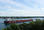
Lake freighter CSL Niagara on the St. Lawrence River near Alexandria Bay in the Thousand Islands.
Autor: w:flickr user kinez, Licencja: CC BY-SA 2.0
The w:Trinity River (Texas) north of downtown Fort Worth, Texas
Baldhill Dam on the Sheyenne River near Valley City, North Dakota, USA. The photograph was taken during the spring 1996 flood on the Red River of the North.
Photo of the Smoky Hill River from the stream gauge station located at 38.711111° N, Longitude: 97.571389 W, Horizontal Datum: NAD27. Photo captioned "Looking downstream, stage 3.17 ft".
Gila River just downstream from the US Highway 95 bridge, (northeast of en:Yuma, Arizona).
The south region of the small en:Laguna Mountains (Arizona) are at photo right. The Gila River is coursing through a short stretch of the also small, en:Gila Valley (Yuma County). The confluence with the Colorado River, is about 8-mi downstream.
(The view is about a due-west view, with riparian brush, Tamarisk, as well as some Tumbleweed plants, growing to maximum heights, and also some maximum height growth of Quailbush (Arizona-California mostly, northwest Mexico), en:Artriplex lentiformis.
Autor: Liz from Fairbanks, AK, USA, Licencja: CC BY 2.0
tanana river east of fairbanks
Autor: Leaflet, Licencja: CC BY-SA 3.0
Colorado River near its source, Borden County, Texas.
Autor: Finetooth, Licencja: CC BY-SA 3.0
Lower Yellowstone Falls on the Yellowstone River in Yellowstone National Park, United States
Autor: Tim Kiser (w:User:Maleaphasant), Licencja: CC BY-SA 2.5
The w:Red River of the North in w:Fargo-Moorhead, as viewed from the Fargo side of the river.
Autor: Garyfrank, Licencja: CC BY-SA 3.0
view of Chattanooga, Tennessee from the north shore of the Tennessee River.
Milk River (AB) Panoramic
Autor: Tim Kiser (w:User:Malepheasant), Licencja: CC BY-SA 2.5
Downtown w:Wheeling, West Virginia and the w:Ohio River as viewed from w:Wheeling Island
Ansel Adams The Tetons and the Snake River (1942) Grand Teton National Park, Wyoming. National Archives and Records Administration, Records of the National Park Service. (79-AAG-1)


