Sławgorod
 | |||
| |||
| Państwo | |||
|---|---|---|---|
| Kraj | Ałtajski | ||
| Mer | Anatolij Kropow | ||
| Populacja (2005) • liczba ludności | 34 800 | ||
| Nr kierunkowy | (+7) 38568 | ||
| Kod pocztowy | 658820 | ||
| Strona internetowa | |||
| Portal | |||
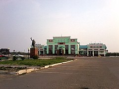
Sławgorod (ros. Славгород) – miasto w azjatyckiej części Rosji, w Kraju Ałtajskim, centrum administracyjne okręgu miejskiego Sławgorod.
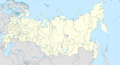
Miasto położone w południowo-zachodniej części Kraju Ałtajskiego, 394 km od Barnaułu i 20 km od granicy z Kazachstanem.
Założone w 1910 roku, status miasta od 1914 i połączenie kolejowe z Koleją Transsyberyjską.
Od 2015 miasto jest siedzibą eparchii sławgorodzkiej[1].
Przypisy
Media użyte na tej stronie
Autor: Uwe Dedering, Licencja: CC BY-SA 3.0
Location map of Russia.
EquiDistantConicProjection : Central parallel :
* N: 54.0° N
Central meridian :
* E: 100.0° E
Standard parallels:
* 1: 49.0° N
* 2: 59.0° N
Made with Natural Earth. Free vector and raster map data @ naturalearthdata.com.
Because the southern Kuril islands are claimed by Russia and Japan, they are shown as disputed. For more information about this see: en:Kuril Islands dispute. These islands are since 1945 under the jurisdiction of the Russian Federation.
Autor: Виктор В, Licencja: CC BY-SA 2.0
Positional map of the Altai Territory
The projection is equiangular.
The standard parallel is 52°30'N.
Template parameters (edge coordinates):Slavgorod (Altai krai), coat of arms


