SDAT Tennis Stadium
 | |
| SDAT Tennis Stadium | |
| Państwo | |
|---|---|
| Miejscowość | Ćennaj |
| Data otwarcia | 1995 |
| Pojemność stadionu | 5800 (główny stadion) |
| Nawierzchnia boiska | Twarda |
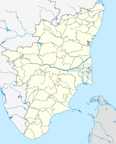
Położenie na mapie Indii | |
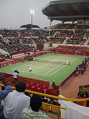
Sports Development Authority of Tamil Nadu Tennis Stadium lub SDAT Tennis Stadium – kompleks tenisowy w hinduskim Ćennaju, w stanie Tamilnadu.
Obiekt wybudowany został w 1995 roku, a w jego skład wchodzi pięć kortów o nawierzchni twardej PlayPave[1]. Największą areną jest kort centralny, który pomieści 5800 widzów[1].
W latach 1997–2017 w SDAT Tennis Stadium odbywał się turniej tenisowy mężczyzn Aircel Chennai Open kategorii ATP World Tour 250[1]. Oprócz rozgrywania turnieju organizowane są również mecze Pucharu Davisa z udziałem reprezentacji Indii.
Przypisy
- ↑ a b c The Venue (ang.). aircelchennaiopen.org. [dostęp 2013-04-27]. [zarchiwizowane z tego adresu (2015-04-26)].
Linki zewnętrzne
- Aircel Channai Open (ang.). aircelchennaiopen.org. [dostęp 2013-04-27]. [zarchiwizowane z tego adresu (2014-01-04)].
Media użyte na tej stronie
The Flag of India. The colours are saffron, white and green. The navy blue wheel in the center of the flag has a diameter approximately the width of the white band and is called Ashoka's Dharma Chakra, with 24 spokes (after Ashoka, the Great). Each spoke depicts one hour of the day, portraying the prevalence of righteousness all 24 hours of it.
Autor: Autor nie został podany w rozpoznawalny automatycznie sposób. Założono, że to Matthewmayer (w oparciu o szablon praw autorskich)., Licencja: CC BY 2.5
Chennai Tennis Open final, January 2005, photo by Matthew Mayer
Original here [1]Autor:
- Gfi-set01-stadium.png: gfi
- derivative work: Frédéric (talk)
icone pour terrain de sport
(c) Uwe Dedering z niemieckiej Wikipedii, CC BY-SA 3.0
Location map of India.
Equirectangular projection. Strechted by 106.0%. Geographic limits of the map:
- N: 37.5° N
- S: 5.0° N
- W: 67.0° E
- E: 99.0° E
Autor: Maximilian Dörrbecker (Chumwa), Licencja: CC BY-SA 3.0
Location map of Tamil Nadu
Autor:
This Image was created by User:PlaneMad.
|
Chennai locator map. Map of Chennai city and Chennai metropolitan area, with major roads, railways and water bodies. Coordinates: top=13.295, bottom=12.844, left=80.00, right=80.3575.


