STS-99
 | |
| Dane misji | |
| Indeks COSPAR | 2000-010A |
|---|---|
| Zaangażowani | |
| Oznaczenie kodowe | STS-99 |
| Pojazd | |
| Wahadłowiec | |
| Załoga | |
 Z przodu od lewej: Mamoru Mōri i Gerhard Thiele, z tyłu od lewej: Janice Voss, Kevin Kregel, Dominic Gorie i Janet Kavandi | |
| Dowódca | Kevin R. Kregel |
| Start | |
| Miejsce startu | |
| Początek misji | 11 lutego 2000 17:43:40 UTC |
| Orbita okołoziemska | |
| Apogeum | 242 km |
| Perygeum | 224 km |
| Okres orbitalny | 89,2 min |
| Inklinacja orbity | 57,0° |
| Lądowanie | |
| Miejsce lądowania | |
| Lądowanie | 22 lutego 2000 23:22:23 UTC[1] |
| Czas trwania misji | 11 dni, 5 godzin, 38 minut i 43 sekundy |
| Przebyta odległość | 6,54 mln km[1] |
| Liczba okrążeń Ziemi | 181[1] |
| Program lotów wahadłowców | |
STS-99 – czternasta jedenastodniowa misja wahadłowca Endeavour agencji NASA i dziewięćdziesiąta siódma programu lotów wahadłowców. Jej głównym celem było zebranie danych wysokościowych SRTM[2].
Załoga
- Kevin R. Kregel (4)* – dowódca
- Dominic L. Pudwill Gorie (2) – pilot
- Janet L. Kavandi (2) – specjalista misji 2
- Janice E. Voss (5) – specjalista misji 3
- Mamoru Mōri (2) – specjalista misji 4 (NASDA Japonia)
- Gerhard Thiele (1) – specjalista misji 1 (Niemcy)
- *(w nawiasie podano liczbę lotów odbytych przez każdego z astronautów)
Parametry misji
- Masa:
- Perygeum: 224 km
- Apogeum: 242 km
- Inklinacja: 57,0°
- Okres orbitalny: 89,2 min
Cel misji
Misja poświęcona opracowaniu map powierzchni Ziemi za pomocą radaru SRTM (ang. Shuttle Radar Topograhic Mission), nawiązująca do lotów z aparaturą SRL – Endeavour STS-59 oraz Endeavour STS-68[2].
Zobacz też
Przypisy
- ↑ a b c podsumowanie misji STS-99 na stronie KSC (ang.)
- ↑ a b c Tomáš Přibyl: Dzień, w którym nie wróciła COLUMBIA. Debit, czerwiec 2003. ISBN 83-7167-224-1.
- ↑ Robert Godwin: Space Shuttle. Warszawa: Prószyński Media Sp. z o.o., 2011, s. 82, seria: Historia podboju Kosmosu. ISBN 978-83-7648-973-5.
- ↑ a b Mark Wade: STS-99 (ang.). W: Encyclopedia Astronautica [on-line]. [dostęp 2017-07-27].
Linki zewnętrzne
- podsumowanie misji STS-99 na stronie KSC (ang.)
- Mark Wade: STS-99 (ang.). W: Encyclopedia Astronautica [on-line]. [dostęp 2017-07-27].
- Spaceflight mission report: STS-99 (ang.). Spacefacts. [dostęp 2017-07-27].
Media użyte na tej stronie
The flag of Navassa Island is simply the United States flag. It does not have a "local" flag or "unofficial" flag; it is an uninhabited island. The version with a profile view was based on Flags of the World and as a fictional design has no status warranting a place on any Wiki. It was made up by a random person with no connection to the island, it has never flown on the island, and it has never received any sort of recognition or validation by any authority. The person quoted on that page has no authority to bestow a flag, "unofficial" or otherwise, on the island.
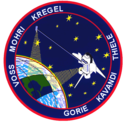
STS099-(S)-001 (JUNE 1999) STS-99 INSIGNIA -- The crew members designed the flight insignia for the Shuttle Radar Topography Mission (SRTM), the most ambitious Earth mapping mission to date. Two radar antennas, one located in the Shuttle bay and the other located on the end of a 60-meter deployable mast, will be used during the mission to map Earth's features. The goal is to provide a 3-dimensional topographic map of the world's surface up to the Arctic and Antarctic Circles. The clear portion of Earth illustrates the radar beams penetrating its cloudy atmosphere and the unique understanding of the home planet that is provided by space travel. The grid on Earth reflects the mapping character of the SRTM mission. The patch depicts the Space Shuttle Endeavour orbiting Earth in a star spangled universe. The rainbow along Earth's horizon resembles an orbital sunrise. The crew deems the bright colors of the rainbow as symbolic of the bright future ahead because of human beings' venturing into space.
An international crew assigned to STS-99 takes a break from training to pose for the traditional crew portrait at NASA's Johnson Space Center (JSC). In front are international astronauts Mamoru Mohri and Gerhard P.J. Thiele, both mission specialists. In back are astronauts Janice Voss, mission specialist; Kevin R. Kregel, mission commander; Dominic L. Gorie, pilot; and Janet L. Kavandi, mission specialist. Mohri represents Japan's National Space Development Agency (NASDA) and Thiele represents the European Space Agency (ESA). The mission is scheduled as an eleven-day flight for late summer/early autumn of this year.


