Saint-Benoît (Vienne)
| miejscowość i gmina | |||
 | |||
| |||
| Państwo | |||
|---|---|---|---|
| Region | |||
| Departament | |||
| Okręg | |||
| Kod INSEE | 86214 | ||
| Powierzchnia | 13,59 km² | ||
| Populacja (1990) • liczba ludności |
| ||
| • gęstość | 430 os./km² | ||
| Kod pocztowy | 86280 | ||
| Portal | |||
Saint-Benoît – miejscowość i gmina we Francji, w regionie Nowa Akwitania, w departamencie Vienne.
Według danych na rok 1990 gminę zamieszkiwały 5 843 osoby, a gęstość zaludnienia wynosiła 430 osób/km² (wśród 1467 gmin regionu Poitou-Charentes, Saint-Benoît plasuje się na 28. miejscu pod względem liczby ludności, natomiast pod względem powierzchni na miejscu 649.).
Bibliografia
- Francuski urząd statystyczny (fr.).
Media użyte na tej stronie
Autor: Eric Gaba (Sting - fr:Sting), Licencja: CC BY-SA 3.0
Blank administrative map of the department of the Vienne, France, for geo-location purpose, with distinct boundaries for regions, departments and arrondissements.
Autor: Superbenjamin, Licencja: CC BY-SA 4.0
Blank administrative map of France for geo-location purpose, with regions and departements distinguished. Approximate scale : 1:3,000,000
Autor: Flappiefh, Licencja: CC BY-SA 4.0
Carte administrative vierge de la région Aquitaine-Limousin-Poitou-Charentes, France, destinée à la géolocalisation.
Autor: Chatsam, Licencja: CC BY-SA 3.0
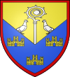
blason des communes de Saint-Benoit : Divisé en chevron renversé : au 1) d’or à la crosse contournée accostée de deux pigeons affrontés, le tout d’argent mouvant de la partition, au 2) d’azur aux trois châteaux donjonnés de trois tourelles d’or, celle du milieu plus haute, ouverts et ajourés du champ, maçonnés de sable ; le tout enfermé dans une filière de gueules.
Autor: Danielclauzier, Licencja: CC BY 3.0
Ancienne abbaye de Saint-Benoît (Vienne, France) aujourd'hui église paroissiale Saint-André.


