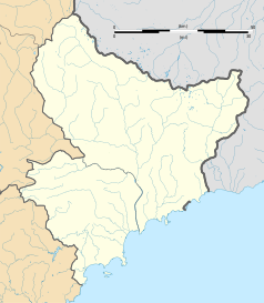
Saint-Blaise (Alpy Nadmorskie)
| miejscowość i gmina | |||
 | |||
| |||
| Państwo | |||
|---|---|---|---|
| Region | |||
| Departament | |||
| Okręg | |||
| Kod INSEE | 06117 | ||
| Powierzchnia | 8 km² | ||
| Populacja (1990) • liczba ludności |
| ||
| • gęstość | 80 os./km² | ||
| Kod pocztowy | 06670 | ||
| Portal | |||
Saint-Blaise – miejscowość i gmina we Francji, w regionie Prowansja-Alpy-Lazurowe Wybrzeże, w departamencie Alpy Nadmorskie.
Według danych na rok 1990 gminę zamieszkiwało 640 osób, a gęstość zaludnienia wynosiła 80 osób/km² (wśród 963 gmin regionu Prowansja-Alpy-W. Lazurowe Saint-Blaise plasuje się na 444. miejscu pod względem liczby ludności, natomiast pod względem powierzchni na miejscu 746.).
Bibliografia
- Francuski urząd statystyczny. (fr.).
Media użyte na tej stronie
Autor: Superbenjamin, Licencja: CC BY-SA 4.0
Blank administrative map of France for geo-location purpose, with regions and departements distinguished. Approximate scale : 1:3,000,000
Autor: Flappiefh, Licencja: CC BY-SA 4.0
Blank administrative map of the region of Provence-Alpes-Côte d'Azur, France, for geo-location purpose.
Autor: Flappiefh, Licencja: CC BY-SA 4.0
Blank administrative map of the department of Alpes-Maritimes, France, for geo-location purpose.
Autor: Jpchevreau, Licencja: CC BY-SA 3.0
Vue sur l'église de Saint-Blaise depuis la route de Levens
Autor: Chatsam, Licencja: CC BY-SA 3.0
blason de la commune de Saint-Blaise : De gueules aux deux cierges allumés d’argent passés en sautoir, à la crosse d’or posées en pal, mouvant de la pointe et brochant sur le tout, au chef aussi d’or chargé d’une étoile de huit rais de gueules accostée de deux croisettes d’azur.


