Saint-Denis-lès-Bourg
| miejscowość i gmina | |||
 | |||
| |||
| Państwo | |||
|---|---|---|---|
| Region | |||
| Departament | |||
| Okręg | |||
| Kanton | Bourg-en-Bresse-2 | ||
| Kod INSEE | 01344 | ||
| Mer | Guillaume Fauvet (2014-2020) | ||
| Powierzchnia | 12,58 km² | ||
| Wysokość | 209-242 m n.p.m. | ||
| Populacja (2012) • liczba ludności |
| ||
| • gęstość | 452,7 os./km² | ||
| Kod pocztowy | 01000 | ||
| Strona internetowa | |||
| Portal | |||
Saint-Denis-lès-Bourg – miejscowość i gmina we Francji, w regionie Owernia-Rodan-Alpy, w departamencie Ain.
Nazwa
Nazwa miejscowości pochodzi od imienia św. Dionizego.
Demografia
Według danych na styczeń 2012 roku gminę zamieszkiwało 5695 osób, a gęstość zaludnienia wynosiła 452,7 osób/km².
Współpraca
 Schutterwald, Niemcy
 Redea, Rumunia
 Shantivanam, Indie
Bibliografia
Media użyte na tej stronie
Autor: Flappiefh, Licencja: CC BY-SA 4.0
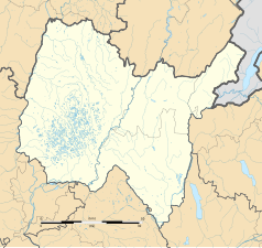
Blank administrative map of the department of Ain, France, for geo-location purpose.
Autor: Superbenjamin, Licencja: CC BY-SA 4.0
Blank administrative map of France for geo-location purpose, with regions and departements distinguished. Approximate scale : 1:3,000,000
Autor: Flappiefh, Licencja: CC BY-SA 4.0
Carte administrative vierge de la région Auvergne-Rhône-Alpes, France, destinée à la géolocalisation.
The Flag of India. The colours are saffron, white and green. The navy blue wheel in the center of the flag has a diameter approximately the width of the white band and is called Ashoka's Dharma Chakra, with 24 spokes (after Ashoka, the Great). Each spoke depicts one hour of the day, portraying the prevalence of righteousness all 24 hours of it.


