Saint-Denis (Sekwana-Saint-Denis)
| miejscowość i gmina | |||
 Bazylika w Saint-Denis | |||
| |||
| Państwo | |||
|---|---|---|---|
| Region | |||
| Departament | |||
| Okręg | |||
| Kanton | Saint-Denis-1, Saint-Denis-2 | ||
| Kod INSEE | 93066 | ||
| Mer | Didier Paillard | ||
| Powierzchnia | 12,36 km² | ||
| Wysokość | 23 – 46 m n.p.m. | ||
| Populacja (2013) • liczba ludności |
| ||
| • gęstość | 8847 os./km² | ||
| Kod pocztowy | 93200, 93210 | ||
Położenie na mapie Sekwana-Saint-Denis (c) Eric Gaba, Wikimedia Commons user Sting, CC BY-SA 3.0 | |||
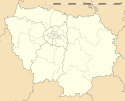
Położenie na mapie Île-de-France (c) Eric Gaba, Wikimedia Commons user Sting, CC BY-SA 3.0 | |||
| Strona internetowa | |||
| Portal | |||
Saint-Denis – miejscowość i gmina we Francji, w regionie Île-de-France, w departamencie Sekwana-Saint-Denis.
Według danych na rok 2013 gminę zamieszkiwało 109 343 osób, a gęstość zaludnienia wynosiła 8847 osób/km² (wśród 1287 gmin regionu Île-de-France Saint-Denis plasuje się na 5. miejscu pod względem liczby ludności, natomiast pod względem powierzchni na miejscu 264.).
Miasto słynie z gotyckiej bazyliki Saint-Denis oraz stadionu olimpijskiego Stade de France. Znajdują się tutaj dwie stacje kolejowe: Gare de Saint-Denis i Gare du Stade de France – Saint-Denis.
Miasta partnerskie
 Kordoba, Hiszpania
 Gera, Niemcy
 North Lanarkshire, Wielka Brytania
 Porto Alegre, Brazylia
 Sesto San Giovanni, Włochy
 Tuzla, Bośnia i Hercegowina
Bibliografia
- Francuski urząd statystyczny. (fr.).
Media użyte na tej stronie
Autor: Superbenjamin, Licencja: CC BY-SA 4.0
Blank administrative map of France for geo-location purpose, with regions and departements distinguished. Approximate scale : 1:3,000,000
(c) Eric Gaba, Wikimedia Commons user Sting, CC BY-SA 3.0
Blank administrative map of the region of Île-de-France, France, as in January 2015, for geo-location purpose, with distinct boundaries for regions, departments and arrondissements.
Autor: Pedro A. Gracia Fajardo, escudo de Manual de Imagen Institucional de la Administración General del Estado, Licencja: CC0
Flaga Hiszpanii
Autor: Patricia.fidi, Licencja: CC0
Unofficial (de facto) flag of the region Île-de-France in France. It was also the flag of the kingdom of France (s.XIV-XV)
Autor: Steve Cadman, Licencja: CC BY-SA 2.0
West facade of the Basilique Saint-Denis.
(c) Eric Gaba, Wikimedia Commons user Sting, CC BY-SA 3.0
Blank administrative map of the department of the Seine-Saint-Denis, France, as in February 2015, for geo-location purpose, with distinct boundaries for departments and arrondissements.
Autor:
| This illustration was made by Peter Potrowl.
Please credit this with : © Peter Potrowl in the immediate vicinity of the image. A link to my website sitemai.eu would be much appreciated but isn't mandatory. An email to
Do not copy this image illegally by ignoring the terms of the license below, as it is not in the public domain.
If you would like special permission to use, license, or purchase the image please contact me More free pictures in my website. Donations are accepted here and here. |
Coat of arms of Saint-Denis (France)
Map of Paris and its inner ring départements, localization of Saint-Denis (Author: Metropolitan).


