Saint-Dié-des-Vosges
| gmina | |||
 | |||
| |||
| Państwo | |||
|---|---|---|---|
| Region | |||
| Departament | |||
| Okręg | |||
| Kod INSEE | 88413 | ||
| Powierzchnia | 46,19 km² | ||
| Populacja (1990) • liczba ludności |
| ||
| • gęstość | 490 os./km² | ||
| Kod pocztowy | 88100 | ||
| Portal | |||
Saint-Dié – gmina we Francji, w regionie Grand Est, w departamencie Wogezy.
Według danych na rok 1990 gminę zamieszkiwało 22 635 osób, a gęstość zaludnienia wynosiła 490 osób/km² (wśród 2335 gmin Lotaryngii Saint-Dié plasuje się na 8. miejscu pod względem liczby ludności, natomiast pod względem powierzchni na miejscu 14.).
Historia
1507 – Cosmographiae Introductio (kosmograf Martin Waldseemüller)
Interesujące miejsca

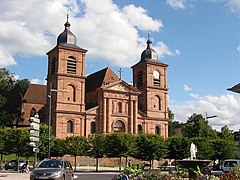
- Katedra
- Krużganek
- Kościół św. Marcina
- Muzeum Pierre-Noël
- Wieża Wolności (fr. Tour de la Liberté) – architekci Nicolas Normier i Jean-Marie Hennin (1989)
- Fabryka Claude et Duval – architekt Le Corbusier (1948-1951)
- Skała Św. Marcina
- Pozostałości celtyckie (fr. Camp celtique de la Bure)
Uczelnie
Uniwersytet Henri Poincaré – IUT (Institut Universitaire de Technologie)
Imprezy, wydarzenia
- Co roku w październiku odbywa się Międzynarodowy Festiwal Geografii (FIG).
Sławni ludzie
- Jules Ferry
- Yvan Goll
Miasta partnerskie
 Arlon
Arlon Cattolica
 Crikvenica
 Friedrichshafen
 Lowell
 Meckhe
 Lorraine
 Zakopane
Bibliografia
- Francuski urząd statystyczny. (fr.).
Linki zewnętrzne
- Saint-Dié-des-Vosges Website
- Instytut Technologii – Institut Universitaire de Technologie
Media użyte na tej stronie
Autor: Boldair, Licencja: CC BY-SA 4.0
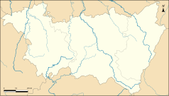
Carte de géolocalisation des Vosges - Administratif
Autor: Superbenjamin, Licencja: CC BY-SA 4.0
Blank administrative map of France for geo-location purpose, with regions and departements distinguished. Approximate scale : 1:3,000,000
Autor: Flappiefh, Licencja: CC BY-SA 4.0
Carte administrative vierge de la région Grand Est, France, destinée à la géolocalisation.
Łatwo można dodać ramkę naokoło tej grafiki
The flag of Navassa Island is simply the United States flag. It does not have a "local" flag or "unofficial" flag; it is an uninhabited island. The version with a profile view was based on Flags of the World and as a fictional design has no status warranting a place on any Wiki. It was made up by a random person with no connection to the island, it has never flown on the island, and it has never received any sort of recognition or validation by any authority. The person quoted on that page has no authority to bestow a flag, "unofficial" or otherwise, on the island.
Flag of Senegal
Flag of Canada introduced in 1965, using Pantone colors. This design replaced the Canadian Red Ensign design.
Autor: Nicolas Normier 2, Licencja: CC BY-SA 4.0
La Tour de la Liberté (Paris 1989) à Saint-Dié-des-Vosges - Hennin Normier Architectes
Autor: Ta ^specifik^ z W3C grafika wektorowa została stworzona za pomocą Inkscape ., Licencja: CC BY-SA 3.0
Blason de la ville de Saint-Dié-des-Vosges, Vosges (88)
Saint-Dié-des-Vosges : Cathédrale
Autor: Florian Cuny, Licencja: CC BY-SA 4.0
Le bâtiment principal de l'IUT de Saint-Dié-des-Vosges, en hiver, en février 2021.


