Saint-Didier-la-Forêt
| gmina | |||
 | |||
| |||
| Państwo | |||
|---|---|---|---|
| Region | |||
| Departament | |||
| Okręg | |||
| Kanton | Escurolles | ||
| Kod INSEE | 03227 | ||
| Mer | Martine Deschamps (2014-2020) | ||
| Powierzchnia | 33,59 km² | ||
| Wysokość | 246-323 m n.p.m. | ||
| Populacja (2015) • liczba ludności |
| ||
| • gęstość | 11,6 os./km² | ||
| Kod pocztowy | 03110 | ||
| Portal | |||
Saint-Didier-la-Forêt – miejscowość i gmina we Francji, w regionie Owernia-Rodan-Alpy, w departamencie Allier.
Demografia
Według danych na rok 1990 gminę zamieszkiwało 375 osób, a gęstość zaludnienia wynosiła 11 osób/km². W styczniu 2015 r. Saint-Didier-la-Forêt zamieszkiwało 388 osób, przy gęstości zaludnienia wynoszącej 11,6 osób/km².
Bibliografia
Media użyte na tej stronie
Autor: Superbenjamin, Licencja: CC BY-SA 4.0
Blank administrative map of France for geo-location purpose, with regions and departements distinguished. Approximate scale : 1:3,000,000
Autor: Flappiefh, Licencja: CC BY-SA 4.0
Carte administrative vierge de la région Auvergne-Rhône-Alpes, France, destinée à la géolocalisation.
Autor: Chatsam, Licencja: CC BY-SA 3.0
blason de la commune de Saint-Didier-la-Forêt :D’or au chêne terrassé de sinople, au loup passant de sable, lampassé de gueules, brochant sur le fût du chêne, au chef du même chargé d’un pal d’argent accosté de deux roses du champ, soutenu d’azur
Autor: Patrick Boyer, Licencja: CC BY-SA 3.0
Abbaye Saint-Gilbert, (Classé
Inscrit, 1969
2001)
Autor: Flappiefh, Licencja: CC BY-SA 4.0
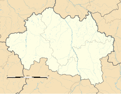
Blank administrative map of the department of Allier, France, for geo-location purpose.


