Saint-Fiel
| miejscowość i gmina | |||
 | |||
| |||
| Państwo | |||
|---|---|---|---|
| Region | |||
| Departament | |||
| Okręg | |||
| Kod INSEE | 23195 | ||
| Powierzchnia | 16,88 km² | ||
| Populacja (1990) • liczba ludności |
| ||
| • gęstość | 42 os./km² | ||
| Kod pocztowy | 23000 | ||
| Portal | |||
Saint-Fiel – miejscowość i gmina we Francji, w regionie Nowa Akwitania, w departamencie Creuse.
Według danych na rok 1990 gminę zamieszkiwało 709 osób, a gęstość zaludnienia wynosiła 42 osoby/km² (wśród 747 gmin Limousin Saint-Fiel plasuje się na 184. miejscu pod względem liczby ludności, natomiast pod względem powierzchni na miejscu 403.).
Bibliografia
- Francuski urząd statystyczny. (fr.).
Media użyte na tej stronie
Autor: Superbenjamin, Licencja: CC BY-SA 4.0
Blank administrative map of France for geo-location purpose, with regions and departements distinguished. Approximate scale : 1:3,000,000
Autor: Flappiefh, Licencja: CC BY-SA 4.0
Carte administrative vierge de la région Aquitaine-Limousin-Poitou-Charentes, France, destinée à la géolocalisation.
Autor: Père Igor, Licencja: CC BY-SA 4.0
Le bourg de Saint-Fiel, Creuse, France.
Autor: Wikisoft* @@@-fr 09:35, 20 December 2012 (UTC), Licencja: GFDL
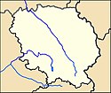
Carte 23 Creuse département fr administrative
Autor: Tretinville, Licencja: CC BY-SA 3.0
D’azur au chevron d’or surmonté d’une étoile et accompagné de trois feuilles de frêne, celles du chef posées dans le sens du chevron, celle de la pointe en pal, le tout du même.


