Saint-Sauveur (Dordogne)
| gmina | |||
 | |||
| |||
| Państwo | |||
|---|---|---|---|
| Region | |||
| Departament | |||
| Okręg | |||
| Kod INSEE | 24499 | ||
| Powierzchnia | 9,31 km² | ||
| Populacja (1990) • liczba ludności |
| ||
| • gęstość | 65 os./km² | ||
| 44°52′06″N 0°35′11″E/44,868333 0,586389 | |||
| Portal | |||
Saint-Sauveur – miejscowość i gmina we Francji, w regionie Nowa Akwitania, w departamencie Dordogne.
Według danych na rok 1990 gminę zamieszkiwało 605 osób, a gęstość zaludnienia wynosiła 65 osób/km² (wśród 2290 gmin Akwitanii Saint-Sauveur plasuje się na 639. miejscu pod względem liczby ludności, natomiast pod względem powierzchni na miejscu 1112.).
Bibliografia
- Francuski urząd statystyczny. (fr.).
Media użyte na tej stronie
Autor: Superbenjamin, Licencja: CC BY-SA 4.0
Blank administrative map of France for geo-location purpose, with regions and departements distinguished. Approximate scale : 1:3,000,000
Autor: Flappiefh, Licencja: CC BY-SA 4.0
Carte administrative vierge de la région Aquitaine-Limousin-Poitou-Charentes, France, destinée à la géolocalisation.
Autor: User:Bourrichon - fr:Bourrichon), Licencja: CC BY-SA 3.0
Blank administrative map of the department of en:Dordogne, France, for geo-location purpose.
Autor: Père Igor, Licencja: CC BY-SA 3.0
La mairie de Saint-Sauveur, Dordogne, France.
Autor: Autor nie został podany w rozpoznawalny automatycznie sposób. Założono, że to Ssire (w oparciu o szablon praw autorskich)., Licencja: CC BY-SA 3.0
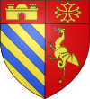
Blasonnement
- Parti, au 1er d'or à trois bandes d'azur; au chef de gueules chargé d'une porte couverte donjonnée de deux tours d'or et ouverte de gueules, au 2e de gueules au dragon d'or lampassé d'argent mis en pal; au chef aussi de gueules à la croix cléchée, vidée et pommetée de douze pièces d'o
Montage graphique : --Ssire (talk) 13:55, 11 May 2012 (UTC)
- Les catégories héraldiques étant devenues délirantes, je renonce à catégoriser quoi que ce soit.


