Saint-Servais (Finistère)
| miejscowość i gmina | |
 | |
| Państwo | |
|---|---|
| Region | |
| Departament | |
| Okręg | |
| Kod INSEE | 29264 |
| Powierzchnia | 10,31 km² |
| Populacja (2013) • liczba ludności |
|
| Kod pocztowy | 29400 |
| Portal | |
Saint-Servais (bret. Sant-Servez-Landivizio) – miejscowość i gmina we Francji, w regionie Bretania, w departamencie Finistère. W 2013 roku populacja gminy wynosiła 845 mieszkańców[1]. Przez miejscowość przepływa rzeka Élorn[2].
Przypisy
- ↑ Populations légales 2013. INSEE. [dostęp 2016-11-26]. (fr.).
- ↑ Fiche cours d’eau – l’Élorn (J34-0300). SANDRE. [dostęp 2016-11-26]. (fr.).
Media użyte na tej stronie
Autor: Superbenjamin, Licencja: CC BY-SA 4.0
Blank administrative map of France for geo-location purpose, with regions and departements distinguished. Approximate scale : 1:3,000,000
Autor: Eric Gaba (Sting - fr:Sting), Licencja: CC BY-SA 3.0
Blank administrative map of the region of Bretagne, France, for geo-location purpose, with distinct boundaries for regions, departments and arrondissements.
Autor: Eric Gaba (Sting - fr:Sting), Licencja: CC BY-SA 3.0
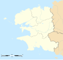
Blank administrative map of the department of Finistère, France, for geo-location purpose, with distinct boundaries for departments and arrondissements.
Autor: Tango7174, Licencja: CC BY-SA 4.0
Enclos paroissial, Saint-Servais, Finistère, Bretagne, France.


