Saint Croix (dopływ Missisipi)
 Rzeka Saint Croix w dolnym biegu, koło Stillwater | |
| Kontynent | |
|---|---|
| Państwo | |
| Lokalizacja | |
| Długość | 272 km |
| Źródło | |
| Miejsce | jezioro Upper Saint Croix, hrabstwo Douglas |
| Wysokość | 310 m n.p.m. |
| Współrzędne | |
| Ujście | |
| Recypient | rzeka Missisipi |
| Miejsce | koło Prescott |
| Wysokość | 214 m n.p.m. |
| Współrzędne | |
| Mapa | |
 Mapa dorzecza | |
Saint Croix (ang. Saint Croix River) – rzeka w Stanach Zjednoczonych, w stanach Wisconsin i Minnesota, dopływ Missisipi. Długość rzeki wynosi 272 km[1].
Rzeka wypływa z jeziora Upper Saint Croix w hrabstwie Douglas, w stanie Wisconsin[1], na wysokości około 310 m n.p.m[2]. Rzeka płynie w kierunku południowo-zachodnim i południowym. Na odcinku 210 km wyznacza znaczny fragment granicy stanów Wisconsin i Minnesota[3]. Do Missisipi uchodzi w pobliżu miasta Prescott, na południowy wschód od aglomeracji Minneapolis–Saint Paul, na wysokości 214 m n.p.m.[2].
Większe miasta położone nad rzeką to St. Croix Falls, Taylors Falls, Osceola, Stillwater, Bayport, Hudson, Lakeland, Lake St. Croix Beach, Afton i Prescott[2].
Przypisy
- ↑ a b U.S. Board on Geographic Names – Download GNIS Data (Pliki: 'Individual State Files – Wisconsin', 'Topical Gazetteers – Feature Description/History', ID: 662324). U.S. Geological Survey. [dostęp 2021-09-05]. (ang.).
- ↑ a b c TopoView. U.S. Geological Survey. [dostęp 2021-09-05]. (ang.).
- ↑ Saint Croix River, [w:] Encyclopædia Britannica [online] [dostęp 2021-09-05] (ang.).
Media użyte na tej stronie
Autor: Uwe Dedering, Licencja: CC BY-SA 3.0
Relief location map of the USA (without Hawaii and Alaska).
EquiDistantConicProjection : Central parallel :
* N: 37.0° N
Central meridian :
* E: 96.0° W
Standard parallels:
* 1: 32.0° N
* 2: 42.0° N
Made with Natural Earth. Free vector and raster map data @ naturalearthdata.com.
Formulas for x and y:
x = 50.0 + 124.03149777329222 * ((1.9694462586094064-({{{2}}}* pi / 180))
      * sin(0.6010514667026994 * ({{{3}}} + 96) * pi / 180))
y = 50.0 + 1.6155950752393982 * 124.03149777329222 * 0.02613325650382181
      - 1.6155950752393982  * 124.03149777329222 *
     (1.3236744353715044  - (1.9694462586094064-({{{2}}}* pi / 180))
      * cos(0.6010514667026994 * ({{{3}}} + 96) * pi / 180))
The flag of Navassa Island is simply the United States flag. It does not have a "local" flag or "unofficial" flag; it is an uninhabited island. The version with a profile view was based on Flags of the World and as a fictional design has no status warranting a place on any Wiki. It was made up by a random person with no connection to the island, it has never flown on the island, and it has never received any sort of recognition or validation by any authority. The person quoted on that page has no authority to bestow a flag, "unofficial" or otherwise, on the island.
Autor: Kmusser, Licencja: CC BY-SA 2.5
Map of the St. Croix River watershed in Wisconsin and Minnesota.
Autor: SANtosito, Licencja: CC BY-SA 4.0
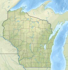
Relief location map of Wisconsin, USA
Geographic limits of the map:
- N: 47.5° N
- S: 42.3° N
- W: 93.1° W
- E: 86.0° W
Autor: SANtosito, Licencja: CC BY-SA 4.0
Relief location map of Minnesota, USA
Geographic limits of the map:
- N: 49.6° N
- S: 43.3° N
- W: 97.4° W
- E: 89.3° W
Autor: Oryginalnym przesyłającym był The.dharma.bum z angielskiej Wikipedii, Licencja: CC BY-SA 2.5
A view of the St. Croix River upstream of (and looking toward) en:Stillwater, Minnesota.


