Saint John (Nowy Brunszwik)
 | |||
| |||
| Państwo | |||
|---|---|---|---|
| Prowincja | |||
| Hrabstwo | |||
| Data założenia | 1604 | ||
| Prawa miejskie | 1785 | ||
| Burmistrz | Ivan Court | ||
| Powierzchnia | 316,31 km² | ||
| Wysokość | 0-387 m n.p.m. | ||
| Populacja (2012) • liczba ludności • gęstość |
| ||
| Nr kierunkowy | 506 | ||
| Kod pocztowy | E2H to E2P | ||
| Strona internetowa | |||
| Portal | |||
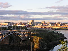
Saint John (fr. Saint-Jean) - największe miasto w kanadyjskiej prowincji Nowy Brunszwik, nad ujściem rzeki Saint John do zatoki Fundy na Oceanie Atlantyckim. Ludność (w 2001) - 69 661, a z uwzględnieniem przedmieść - 122 697 mieszkańców.
Ujście rzeki Saint John zostało przez Europejczyków zbadane i naniesione na mapy po raz pierwszy w 1604, kiedy przybył tu francuski kartograf i kolonizator Samuel de Champlain wraz z osadnikami pod wodzą innego francuskiego badacza, Pierre’a du Gua de Monsa.
Liczba mieszkańców Saint John wynosi 68 043. Język angielski jest językiem ojczystym dla 90,3%, francuski dla 5,2% mieszkańców (2006)[1].
W mieście rozwinął się przemysł chemiczny, petrochemiczny, spożywczy, stoczniowy, drzewny, metalowy oraz poligraficzny[2].
Sport
- Saint John Sea Dogs – klub hokejowy
Miasta partnerskie
Przypisy
- ↑ Statistics Canada. 2006 Community Profiles / Statistique Canada. Profils des communautés de 2006
- ↑ Saint John, [w:] Encyklopedia PWN [online] [dostęp 2021-08-09].
Media użyte na tej stronie
The flag of Navassa Island is simply the United States flag. It does not have a "local" flag or "unofficial" flag; it is an uninhabited island. The version with a profile view was based on Flags of the World and as a fictional design has no status warranting a place on any Wiki. It was made up by a random person with no connection to the island, it has never flown on the island, and it has never received any sort of recognition or validation by any authority. The person quoted on that page has no authority to bestow a flag, "unofficial" or otherwise, on the island.
Autor: NordNordWest, Licencja: CC BY-SA 3.0
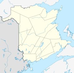
Location map of New Brunswick, Canada
I took this photo in July 2006 and am putting it here in the Commons for all to use. In the picture is also the reversingfalls restaurant.
Autor: Dbenbenn (original)
E Pluribus Anthony (current), Licencja: CC0
Flag of New Brunswick.
Autor: Yug, Licencja: CC-BY-SA-3.0
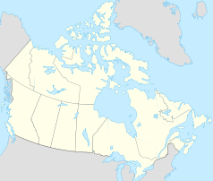
cropped version of Carte administrative du Canada.svg for map location.


