Salses-le-Château
| miejscowość i gmina | |||
 Salses-le-Château (2008) | |||
| |||
| Państwo | |||
|---|---|---|---|
| Region | |||
| Departament | |||
| Okręg | |||
| Kod INSEE | 66190 | ||
| Powierzchnia | 71,24 km² | ||
| Populacja (1990) • liczba ludności |
| ||
| • gęstość | 34 os./km² | ||
| Kod pocztowy | 66600 | ||
Położenie na mapie Pirenejów Wschodnich © Hawk-Eye, CC BY-SA 3.0 | |||
| Strona internetowa | |||
| Portal | |||
Salses-le-Château – miejscowość i gmina we Francji, w regionie Oksytania, w departamencie Pireneje Wschodnie.
Według danych na rok 1990 gminę zamieszkiwały 2422 osoby, a gęstość zaludnienia wynosiła 34 osoby/km² (wśród 1545 gmin Langwedocji-Roussillon Salses-le-Château plasuje się na 155. miejscu pod względem liczby ludności, natomiast pod względem powierzchni na miejscu 18.).
Zabytki
Zabytki na terenie gminy posiadające status monument historique[1]:
- Baraque Cabrol
- Café de la Loge
- Camp de Rivesaltes
- Fort Salses (Forteresse de Salses) – fort obronny, którego budowę rozpoczęto w 1497 roku, a przebudowano w 1691 roku[2].
Populacja
Przypisy
- ↑ Monuments historiques de Pyrénées-Orientales. culture.gouv.fr. [dostęp 2016-06-17]. (fr.).
- ↑ Henri Stierlin: Zabytki architektury obronnej. Warszawa: Wydawnictwo G+J RBA Sp. z o.o. & Co. Spółka Komandytowa. ISBN 83-60006-16-4.
Bibliografia
- Francuski urząd statystyczny. (fr.).
Linki zewnętrzne
Media użyte na tej stronie
Autor: Superbenjamin, Licencja: CC BY-SA 4.0
Blank administrative map of France for geo-location purpose, with regions and departements distinguished. Approximate scale : 1:3,000,000
Autor: Flappiefh, Licencja: CC BY-SA 4.0
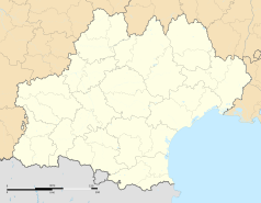
Carte administrative vierge de la région Languedoc-Roussillon-Midi-Pyrénées, France, destinée à la géolocalisation.
Autor: H. Zell, Licencja: CC BY-SA 3.0
This building is classé au titre des monuments historiques de la France. It is indexed in the base Mérimée, a database of architectural heritage maintained by the French Ministry of Culture, under the reference PA00104129
Main road crossing the city of Salses-le-Château center, in Pyrénées-Orientales, France.
Autor: Celbusro, Licencja: CC BY-SA 4.0
Blasonnement : d'azur à saint Étienne au naturel, sur une terrasse d'or, tenant de sa main dextre une palme de sinople et de sa senestre un livre d'argent accompagné de six fleurs de lis d'or rangées en pal, trois à dextre et trois à senestre.
Autor: GautierPoupeau, Licencja: CC BY-SA 3.0
Cour de la Forteresse de Salses
Autor: Mcapdevila, Licencja: CC BY-SA 3.0
CASTLE OF SALSES in the Roussillon s.xv
Autor: Michiel1972, Licencja: CC BY-SA 3.0
Population - Municipality code 66190.svg
Population Census 1962-2008© Hawk-Eye, CC BY-SA 3.0
Blank administrative map of the department of Pyrénées-Orientales, France, for geo-location purpose.
Autor: Groumfy69, Licencja: CC BY-SA 3.0
Côté Ouest de la forteresses de Salses


