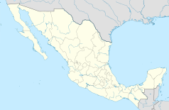
Saltillo (Coahuila)
| |||
 Od góry do dołu i od lewej do prawej: Teatr Miejski Fernando Soler, Katedra Saltillo, Plaza de la Nueva Tlaxcala, Pałac Rządowy, Pałac Kongresu Stanu Coahuila, Muzeum Ptaków Meksyku i Panorama miasta | |||
| |||
| Państwo | |||
| Stan | |||
| Burmistrz | Manolo Jiménez Salinas (2018-2021)[1] | ||
| Powierzchnia | 272 km² | ||
| Wysokość | 1600 m n.p.m. | ||
| Populacja (2020) • liczba ludności | 879 958 | ||
| Nr kierunkowy | 844 | ||
| Kod pocztowy | 25000 | ||
| Tablice rejestracyjne | 5 | ||
| Strona internetowa | |||
Saltillo – miasto w północnym Meksyku[2], w górach Sierra Madre Wschodnia[2], na wysokości około 1600 metrów[2], stolica stanu Coahuila[2]. Około 591 tys. mieszkańców.
Miasto założone zostało w XVI wieku[2].
Miasta partnerskie
 Lansing, Stany Zjednoczone[3]
 Auburn Hills, Stany Zjednoczone[3]
 Fort Worth, Stany Zjednoczone[4]
 Windsor, Kanada[3]
 Fredericton, Kanada[4]
 Alma, Kanada[4]
 Coyoacán, Meksyk[4]
 Gwatemala, Gwatemala[3]
 San José, Kostaryka[3]
 Holguín, Kuba[3]
 Itagüí, Kolumbia[3]
 Córdoba, Argentyna[3]
 Tlaxcala, Meksyk[3]
 Álvaro Obregón, Meksyk[3]
 Bustamante, Meksyk[4]
 Torreón, Meksyk[4]
 San Buenaventura, Meksyk[5]
 Progreso, Meksyk[6]
 Austin, Stany Zjednoczone[3]
 Reynosa, Meksyk[3]
 Santiago, Meksyk[3]
 Orlando, Stany Zjednoczone[3]
 Guadalajara, Meksyk[7]
Przypisy
- ↑ Manolo Jiménez con 174 mil votos hizo historia en Saltillo (hiszp.). vanguardia.com.mx, 2018-07-07. [dostęp 2021-09-12].
- ↑ a b c d e Encyklopedia Powszechna PWN. T. 4. Warszawa: Państwowe Wydawnictwo Naukowe, 1976, s. 123.
- ↑ a b c d e f g h i j k l m n Eduardo Campa: Buscan hermanar a Saltillo y Orlando (hiszp.). losdelegados.com, 2012-12-19. [dostęp 2021-09-12]. [zarchiwizowane z tego adresu].
- ↑ a b c d e f Césa Gaytán Martínez: Lazos Culturales: Saltillo y sus 17 hermanas (hiszp.). vanguardia.com.mx, 2013-06-28. [dostęp 2021-09-12]. [zarchiwizowane z tego adresu].
- ↑ Dona alcalde de Saltillo mil lámparas a Gladys (hiszp.). eltiempomonclova.mx, 2019-12-18. [dostęp 2021-09-12].
- ↑ Se hermanan Saltillo y Progreso: los alcaldes Lico Quintanilla y Manolo Jiménez firman convenio de colaboración (hiszp.). noticiascarbonifera.com, 2020-01-18. [dostęp 2021-09-12].
- ↑ Guadalajara (ang.). en.db-city.com. [dostęp 2021-09-12].
Media użyte na tej stronie
The flag of Navassa Island is simply the United States flag. It does not have a "local" flag or "unofficial" flag; it is an uninhabited island. The version with a profile view was based on Flags of the World and as a fictional design has no status warranting a place on any Wiki. It was made up by a random person with no connection to the island, it has never flown on the island, and it has never received any sort of recognition or validation by any authority. The person quoted on that page has no authority to bestow a flag, "unofficial" or otherwise, on the island.
Flag of the State of Coahuila, Mexico.
Autor: Hachiroo, Licencja: CC BY-SA 3.0
Montaje de imágenes de Saltillo. De arriba a abajo de izquierda a derecha:
- Teatro de la Ciudad Fernando Soler.
- Catedral de Saltillo
- Plaza de la Nueva Tlaxcala
- Palacio de Gobierno
- Palacio del Congreso del Estado de Coahuila
- Museo de las Aves de México
- Panorámica de la ciudad
Location Map of Coahuila Equirectangular projection, Geographic limits of the map:
- N: 29.94° N
- S: 24.48° N
- W: 104.00° W
- E: 99.70° W
Escudo del municipio de Saltillo


