San Juan (wyspa)
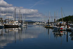
 Friday Harbor | |
| Kontynent | |
|---|---|
| Państwo | |
| Akwen | Zatoka Puget (Ocean Spokojny) |
| Archipelag | |
| Powierzchnia | 142,59 km² |
| Populacja • liczba ludności • gęstość |
|
 | |
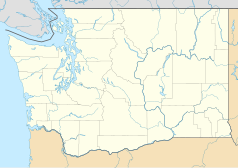
San Juan to druga pod względem wielkości i najbardziej zaludniona spośród 743 wysp San Juan. Administracyjnie należy, jak wszystkie te wyspy, do hrabstwa San Juan i stanu Waszyngton.
Nazwę nadał wyspie w 1791 hiszpański podróżnik Juan Francisco de Eliza na cześć świętego Jana Chrzciciela (hiszp. San Juan el Bautista). Od jej nazwy swoje miano bierze archipelag San Juan, którego wyspa jest częścią, oraz hrabstwo San Juan.
Największym i jedynym formalnie zorganizowanym osiedlem na wyspie jest Friday Harbor, liczące poniżej 2000 mieszkańców (2000). Poza tym ludność zamieszkuje jeszcze m.in. okolice kurortu nad Zatoką Roche (ang. Roche Harbor).
Miejscowa ludność utrzymuje się głównie z pracy w instytucjach i usługach miejskich, rolnictwa oraz turystyki. Wielką atrakcją turystyczną wyspy jest narodowy park historyczny, San Juan Island National Historical Park, w którym eksponowane są pozostałości instalacji militarnych z okresu amerykańsko-brytyjskiego konfliktu granicznego z 1859 roku, którego wyspa była przedmiotem tzw. świńskiej wojny.
Media użyte na tej stronie
The flag of Navassa Island is simply the United States flag. It does not have a "local" flag or "unofficial" flag; it is an uninhabited island. The version with a profile view was based on Flags of the World and as a fictional design has no status warranting a place on any Wiki. It was made up by a random person with no connection to the island, it has never flown on the island, and it has never received any sort of recognition or validation by any authority. The person quoted on that page has no authority to bestow a flag, "unofficial" or otherwise, on the island.
Autor: Alexrk2, Licencja: CC BY 3.0
Ta mapa została stworzona za pomocą GeoTools.
Major islands of the San Juans. My own work.
Autor: Uwe Dedering, Licencja: CC BY-SA 3.0
Relief location map of the USA (without Hawaii and Alaska).
EquiDistantConicProjection : Central parallel :
* N: 37.0° N
Central meridian :
* E: 96.0° W
Standard parallels:
* 1: 32.0° N
* 2: 42.0° N
Made with Natural Earth. Free vector and raster map data @ naturalearthdata.com.
Formulas for x and y:
x = 50.0 + 124.03149777329222 * ((1.9694462586094064-({{{2}}}* pi / 180))
      * sin(0.6010514667026994 * ({{{3}}} + 96) * pi / 180))
y = 50.0 + 1.6155950752393982 * 124.03149777329222 * 0.02613325650382181
      - 1.6155950752393982  * 124.03149777329222 *
     (1.3236744353715044  - (1.9694462586094064-({{{2}}}* pi / 180))
      * cos(0.6010514667026994 * ({{{3}}} + 96) * pi / 180))


