San Sebastián de los Reyes
| Ten artykuł od 2016-11 wymaga zweryfikowania podanych informacji. |
| |||||
 | |||||
| Państwo | |||||
| Wspólnota autonomiczna | |||||
| Burmistrz | Manuel Ángel Fernández Mateo | ||||
| Powierzchnia | 59 km² | ||||
| Wysokość | 705 m n.p.m. | ||||
| Populacja (2009) • liczba ludności • gęstość | 75 912 1 227,36 os./km² | ||||
| Kod pocztowy | 28701-28703, 28706-28709 | ||||
| Tablice rejestracyjne | M | ||||
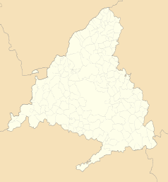
Położenie na mapie wspólnoty autonomicznej Madrytu (c) Miguillen, CC BY-SA 3.0 | |||||
| Strona internetowa | |||||
| Portal | |||||
San Sebastián de los Reyes – miasto w regionie Madryt. Położone 18 km od centrum Madrytu.
- (c) Carlos Delgado, CC BY-SA 3.0
Miasta partnerskie
Linki zewnętrzne
Media użyte na tej stronie
Autor: NordNordWest, Licencja: CC BY-SA 3.0
Location map of Spain
Equirectangular projection, N/S stretching 130 %. Geographic limits of the map:
- N: 44.4° N
- S: 34.7° N
- W: 9.9° W
- E: 4.8° E
Autor: Pedro A. Gracia Fajardo, escudo de Manual de Imagen Institucional de la Administración General del Estado, Licencja: CC0
Flaga Hiszpanii
Autor: Ayuntamiento de S. S. de los Reyes, Licencja: CC-BY-SA-3.0
Plaza de la Constitución de San Sebastián de los Reyes, Madrid, España
Autor: Ayuntamiento San Sebastián de los Reyes, Licencja: CC-BY-SA-3.0
Encierro San Sebastián de los Reyes Calle Estafeta
Autor: See file history, Licencja: CC0
Flag of the Community of Madrid (Spain)
(c) Carlos Delgado, CC BY-SA 3.0
San Sebastián de los Reyes and Alcobendas seen from a plane from the west.
Autor: Heralder, Licencja: CC BY-SA 3.0
Coat of arms of San Sebastián de los Reyes, Community of Madrid (Spain)


