Santa Clara (Kuba)
| |||||
 Mauzoleum Ernesto „Che” Guevary | |||||
| |||||
| Państwo | |||||
| Prowincja | Villa Clara | ||||
| Powierzchnia | 514 km² | ||||
| Wysokość | 125 m n.p.m. | ||||
| Populacja (2004) • liczba ludności • gęstość | 237 581 462,2 os./km² | ||||
| Nr kierunkowy | +53-422 | ||||
| Kod pocztowy | 50100 | ||||
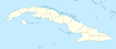
Santa Clara – miasto w środkowej Kubie, przy drodze samochodowej Carretera Central, stolica prowincji Villa Clara. Około 205,8 tys. mieszkańców. Znajduje się w nim Mauzoleum Ernesto „Che” Guevary, wystawione w miejscu, w którym między 28 grudnia 1958 a 1 stycznia 1959 toczyła się bitwa decydująca o losach rewolucji kubańskiej.
Transport
Miasta partnerskie
Linki zewnętrzne
Media użyte na tej stronie
Autor: Pedro A. Gracia Fajardo, escudo de Manual de Imagen Institucional de la Administración General del Estado, Licencja: CC0
Flaga Hiszpanii
The flag of Navassa Island is simply the United States flag. It does not have a "local" flag or "unofficial" flag; it is an uninhabited island. The version with a profile view was based on Flags of the World and as a fictional design has no status warranting a place on any Wiki. It was made up by a random person with no connection to the island, it has never flown on the island, and it has never received any sort of recognition or validation by any authority. The person quoted on that page has no authority to bestow a flag, "unofficial" or otherwise, on the island.
Autor: Dэя-Бøяg, Licencja: GPL
Flag of the Cuban city of Santa Clara.
Autor: Guillaume Baviere from Uppsala, Sweden, Licencja: CC BY 2.0
Santa Clara. Au mausolée de Che Guevara.


