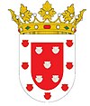
Santiago de los Caballeros
| Ten artykuł od 2014-04 wymaga zweryfikowania podanych informacji. |
| |||
| |||
| Państwo | |||
| Prowincja | Santiago | ||
| Burmistrz | José Enrique Sued | ||
| Powierzchnia | 524,03 km² | ||
| Wysokość | 175 m n.p.m. | ||
| Populacja (2008) • liczba ludności | 993 629 | ||
| Nr kierunkowy | 809/829 | ||
| Strona internetowa | |||
Santiago de los Caballeros – miasto w Republice Dominikańskiej założone w 1495 roku podczas pierwszej fali europejskiej kolonizacji Nowego Świata, obecnie jest drugie co do wielkości w kraju.
Santiago de los Caballeros jest pierwszym Santiago założonym w Ameryce Łacińskiej, znanym także jako Santiago de los 30 Caballeros. Jest stolicą prowincji Santiago.
Historia
Pierwotnie osada nazywała się Jacagua, jednak została zniszczona podczas trzęsienia ziemi w 1506 roku i została przeniesiona do obecnej lokalizacji. W 1562 została zniszczona przez kolejne trzęsienie ziemi. Santiago de los Caballeros swego czasu było stolicą kraju oraz było ważnym strategicznym miastem podczas Dominikańskiej Wojny o Niepodległość w 1844 roku.
Współcześnie
Santiago jest drugim co do wielkości miastem Dominikany oraz trzecim na wyspie Hispaniola. Populacja Santiago liczy ponad 600 000 mieszkańców. Gospodarka opiera się głównie na sektorze usług, miasto posiada jedną z największych wolnych stref ekonomicznych w kraju. Ośrodek handlowy regionu uprawy kakaowca, kawowca i tytoniu. Międzynarodowe lotnisko: Aeropuerto Internacional del Cibao. Drużyna baseballa: Aguilas Cibeñas. Główne uniwersytety: PUCMM (Pontifícia Universidad Católica Madre y Maestra), UTESTA (La Universidad Tecnológica de Santiago).
Miasta partnerskie
Media użyte na tej stronie
The flag of the Dominican Republic has a centered white cross that extends to the edges. This emblem is similar to the flag design and shows a bible, a cross of gold and 6 Dominican flags. There are branches of olive and palm around the shield and above on the ribbon is the motto "Dios,Patria!, Libertad" ("God, Country, Freedom") and to amiable freedom. The blue is said to stand for liberty, red for the fire and blood of the independence struggle and the white cross symbolized that God has not forgotten his people. "Republica Dominicana". The Dominican flag was designed by Juan Pablo Duarte, father of the national Independence of Dominican Republic. The first dominican flag was sewn by a young lady named Concepción Bona, who lived across the street of El Baluarte, monument where the patriots gathered to fight for the independence, the night of February 27th, 1844. Concepción Bona was helped by her first cousin María de Jesús Pina.
The flag of Navassa Island is simply the United States flag. It does not have a "local" flag or "unofficial" flag; it is an uninhabited island. The version with a profile view was based on Flags of the World and as a fictional design has no status warranting a place on any Wiki. It was made up by a random person with no connection to the island, it has never flown on the island, and it has never received any sort of recognition or validation by any authority. The person quoted on that page has no authority to bestow a flag, "unofficial" or otherwise, on the island.
Autor: User:Merlin, Licencja: CC-BY-SA-3.0
Dominicana, Santiago de los Caballeros - Monument to the Heroes of the Restoriation
(c) Lacreta z angielskiej Wikipedii, CC BY-SA 3.0
Santiago City seen from the HOMS (10th floor) (Own work)
Autor: Alexrk2, Licencja: CC BY-SA 3.0
Location map Dominican Republic with Provinces, Equirectangular projection, N/S stretching 105 %. Geographic limits of the map:
Sello de Santiago, Rep Dom


