Saratoga Springs (Nowy Jork)
 Centrum Saratoga Springs | |||||
| |||||
| Dewiza: Zdrowie, historia, konie (ang. Health, History, Horses) | |||||
| Przydomek: Miasto uzdrowiska (ang. The Spa City) | |||||
| Państwo | |||||
|---|---|---|---|---|---|
| Stan | |||||
| Hrabstwo | |||||
| Data założenia | 1776 | ||||
| Prawa miejskie | 7 kwietnia 1915 | ||||
| Kod statystyczny | |||||
| Burmistrz | Joanne Yepsen[1](stan na 9 lipca 2014) | ||||
| Powierzchnia | 75,2 km² | ||||
| Wysokość | 91 m n.p.m. | ||||
| Populacja (2010) • liczba ludności |
| ||||
| Nr kierunkowy | 518 | ||||
| Kod pocztowy | 12866 | ||||
| Strefa czasowa | |||||
Położenie na mapie stanu Nowy Jork (c) NordNordWest, CC BY 3.0 | |||||
| Strona internetowa | |||||
| Portal | |||||
Saratoga Springs – miasto w Stanach Zjednoczonych, w stanie Nowy Jork. W 2010 r. miasto to na powierzchni 355,6 km² zamieszkiwało 26 586 osób[2]. Dla porównania, w 1970 mieszkańców było 18,8 tys.[3]
W 1684 do miasta zaczęli napływać Holendrzy, a od 1784 rozpoczęło się osadnictwo amerykańskie. W 1777 w okolicy miały miejsce dwie bitwy między armią amerykańską a angielską. W miejscowości znajduje się uzdrowisko oraz liczne budowle reprezentacyjne z początku XIX wieku[3].
W mieście rozwinął się przemysł włókienniczy oraz elektroniczny[4]
Miasta partnerskie
Przypisy
- ↑ City of Saratoga Springs: Office of the Mayor (ang.). [dostęp 2014-07-09]. [zarchiwizowane z tego adresu (2014-07-14)].
- ↑ a b Saratoga Springs city, New York. Census 2010. American FactFinder. [dostęp 2014-06-18]. [zarchiwizowane z tego adresu (18 stycznia 2015)].
- ↑ a b Encyklopedia Powszechna PWN. T. 3. M-R. Warszawa: Państwowe Wydawnictwo Naukowe, 1975, s. 139.
- ↑ Saratoga Springs, [w:] Encyklopedia PWN [online] [dostęp 2021-08-10].
Media użyte na tej stronie
(c) NordNordWest, CC BY 3.0
Location map of the State of New York, USA
Autor: Uwe Dedering, Licencja: CC BY-SA 3.0
Location map of the USA (without Hawaii and Alaska).
EquiDistantConicProjection:
Central parallel:
* N: 37.0° N
Central meridian:
* E: 96.0° W
Standard parallels:
* 1: 32.0° N
* 2: 42.0° N
Made with Natural Earth. Free vector and raster map data @ naturalearthdata.com.
Formulas for x and y:
x = 50.0 + 124.03149777329222 * ((1.9694462586094064-({{{2}}}* pi / 180))
      * sin(0.6010514667026994 * ({{{3}}} + 96) * pi / 180))
y = 50.0 + 1.6155950752393982 * 124.03149777329222 * 0.02613325650382181
      - 1.6155950752393982  * 124.03149777329222 *
     (1.3236744353715044  - (1.9694462586094064-({{{2}}}* pi / 180))
      * cos(0.6010514667026994 * ({{{3}}} + 96) * pi / 180))
The flag of Navassa Island is simply the United States flag. It does not have a "local" flag or "unofficial" flag; it is an uninhabited island. The version with a profile view was based on Flags of the World and as a fictional design has no status warranting a place on any Wiki. It was made up by a random person with no connection to the island, it has never flown on the island, and it has never received any sort of recognition or validation by any authority. The person quoted on that page has no authority to bestow a flag, "unofficial" or otherwise, on the island.
Autor: JB82, Licencja: CC BY-SA 4.0
The Saratoga Springs, NY city flag at Congress Park
Autor: UpstateNYer, Licencja: CC BY-SA 3.0
Downtown Saratoga Springs, New York, United States
Autor: JB82, Licencja: CC BY-SA 4.0
The seal of the City of Saratoga Springs as depicted at Waterfront Park
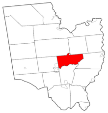
Map of Saratoga County highlighting Saratoga Springs


