Sartène
| gmina | |||
 | |||
| |||
| Państwo | |||
|---|---|---|---|
| Region | |||
| Departament | |||
| Okręg | |||
| Kod INSEE | 2A272 | ||
| Powierzchnia | 195,83 km² | ||
| Populacja (1990) • liczba ludności |
| ||
| • gęstość | 18 os./km² | ||
| Portal | |||
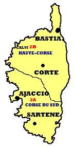
Sartène (korsyk. Sartè) – miasteczko i gmina we Francji, w regionie Korsyka, w departamencie Korsyka Południowa, jest stolicą korsykańskiego regionu Sartènais. Sartène szczyci się tym, że jest najbardziej korsykańskim z wszystkich korsykańskich miejscowości. Sartène podobnie jak wszystkie prawie miejscowości korsykańskie jest podzielone na część górną i dolną. Centralnym punktem miasta jest Plac Wolności (Place de la Libération), przy którym znajduje się lokalny ratusz. Poza lipcowo-sierpniowym szczytem turystycznym Sartène pozostaje malowniczą oazą spokoju otoczoną licznymi winnicami.
Według danych na rok 1990 gminę zamieszkiwało 3525 osób, a gęstość zaludnienia wynosiła 18 osób/km².
Zobacz też
Linki zewnętrzne
- Źródło danych: Francuski urząd statystyczny. (fr.).
- Sartène na mapie Mapquest'u
Media użyte na tej stronie
Autor: Superbenjamin, Licencja: CC BY-SA 4.0
Blank administrative map of France for geo-location purpose, with regions and departements distinguished. Approximate scale : 1:3,000,000
Autor: Jean-Pol GRANDMONT, Licencja: CC BY 3.0
Sartène (Corse du Sud), France, the old city.
Autor: Eric Gaba (Sting - fr:Sting), Licencja: CC BY-SA 3.0
Blank administrative map of the department of Corse-du-Sud, France, for geo-location purpose, with distinct boundaries for departments and arrondissements.
Autor: Eric Gaba (Sting - fr:Sting), Licencja: CC BY-SA 3.0
Blank administrative map of the region of Corsica, France, for geo-location purpose, with distinct boundaries for departments and arrondissements as they are since January 2010.
The former version of the map shows the boundaries as they were until December 2009.
Autor: Tretinville, Licencja: CC BY-SA 3.0
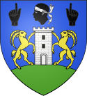
D'azur à la tour carrée d'argent, maçonné et ajourée de sable, posée sur un mont de sinople, soutenue par deux mouflons affrontés d'or et surmontée d'une tête de Maure au naturel, tortillée d'argent, accostée de deux mains adossées de sable, l'index levé.


