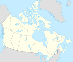
Sault Ste. Marie (Kanada)
 | |
| Państwo | |
|---|---|
| Prowincja | |
| Burmistrz | John Rowswell |
| Powierzchnia | 221,71 km² |
| Populacja (2006) • liczba ludności • gęstość |
|
| Nr kierunkowy | 705 |
| Strona internetowa | |
| Portal | |
Sault Ste. Marie (fr. Sault-Sainte-Marie) – miasto w Kanadzie, w prowincji Ontario, w dystrykcie Algoma. Leży nad graniczną rzeką St. Marys, naprzeciwko amerykańskiego miasta o tej samej nazwie.
Liczba mieszkańców Sault Ste. Marie wynosi 74 948. Język angielski jest językiem ojczystym dla 83,5%, francuski dla 4,1% mieszkańców (2006)[1].
Sport
Współpraca
 Louth, Irlandia
 Forssa, Finlandia
 Maia, Portugalia
 Sault Ste. Marie, Stany Zjednoczone
 Krasnojarsk, Rosja
Przypisy
Media użyte na tej stronie
Autor: Yug, Licencja: CC-BY-SA-3.0
cropped version of Carte administrative du Canada.svg for map location.
Flaga Finlandii
Flag of Portugal, created by Columbano Bordalo Pinheiro (1857-1929), officially adopted by Portuguese government in June 30th 1911 (in use since about November 1910). Color shades matching the RGB values officially reccomended here. (PMS values should be used for direct ink or textile; CMYK for 4-color offset printing on paper; this is an image for screen display, RGB should be used.)
The flag of Navassa Island is simply the United States flag. It does not have a "local" flag or "unofficial" flag; it is an uninhabited island. The version with a profile view was based on Flags of the World and as a fictional design has no status warranting a place on any Wiki. It was made up by a random person with no connection to the island, it has never flown on the island, and it has never received any sort of recognition or validation by any authority. The person quoted on that page has no authority to bestow a flag, "unofficial" or otherwise, on the island.
Autor: NordNordWest, Licencja: CC BY-SA 3.0
Location map of Ontario, Canada
Aerial picture of the Soo Locks (downriver view) — in Michigan between Lake Superior and Lake Huron.
- Located between the cities of Sault Ste. Marie, Michigan, USA (right) and Sault Ste. Marie, Ontario, Canada (left).
- Whitefish Island is just to the left of the rapids, with the Canadian Sault Ste. Marie Canal partially in view to its left.
Flag of Ontario.


