Schönberg im Stubaital
| |||
 | |||
| |||
| Państwo | |||
| Kraj związkowy | |||
| Powiat | Innsbruck-Land | ||
| Powierzchnia | 7,47 km² | ||
| Wysokość | 1013 m n.p.m. | ||
| Populacja (1 stycznia 2015) • liczba ludności | 1008 | ||
| • gęstość | 135 os./km² | ||
| Numer kierunkowy | 05225 | ||
| Kod pocztowy | 6141 | ||
| Tablice rejestracyjne | IL | ||
| Strona internetowa | |||
Schönberg im Stubaital – gmina w Austrii, w kraju związkowym Tyrol, w powiecie Innsbruck-Land. Według Austriackiego Urzędu Statystycznego liczyła 1008 mieszkańców (1 stycznia 2015)[1].
Zobacz też
Przypisy
Media użyte na tej stronie
Autor: Rosso Robot, Licencja: CC BY-SA 3.0
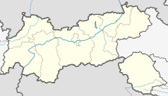
Location map of The Tyrol
Equirectangular projection. Geographic limits of the map:
- N: 47.75317° N
- S: 46.64119° N
- W: 10.08236° E
- E: 12.98961° E
Autor: Lencer, Licencja: CC BY-SA 3.0
Location map of Austria
Equirectangular projection, N/S stretching 150 %. Geographic limits of the map:
- N: 49.2° N
- S: 46.3° N
- W: 9.4° E
- E: 17.2° E
Autor: Anna reg, Licencja: CC BY-SA 3.0 at
This media shows the remarkable cultural object in the Austrian state of Tyrol listed by the Tyrolean Art Cadastre with the ID
41729. (on tirisMaps, pdf, more images on Commons, Wikidata) 


