Schouwen-Duiveland
| |||||
 | |||||
| Państwo | |||||
| Prowincja | |||||
| Burmistrz | Gerard Rabelink (2014)[1] | ||||
| Powierzchnia | 488.94 km² | ||||
| Populacja (2012) • liczba ludności • gęstość | 31 988 65 os./km² | ||||
| Nr kierunkowy | 0111 | ||||
| Kod pocztowy | 4300-4329 | ||||
 | |||||
| Strona internetowa | |||||
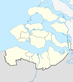
Schouwen-Duiveland – miasto oraz wyspa w południowej Holandii, w prowincji Zelandia, w pobliżu granicy z Belgią. Około 32 tys. mieszkańców. Jest największym miastem na wyspie o tej samej nazwie.
Przypisy
- ↑ schouwen-duiveland.nl: De Gemeenteraad (niderl.). [dostęp 2014-07-12].
Media użyte na tej stronie
Autor: Erik Frohne, Licencja: CC BY-SA 3.0
Location map of province Zeeland in the Netherlands
Equirectangular projection, N/S stretching 160 %. Geographic limits of the map:
- N: 51.80° N
- S: 51.10° N
- W: 3.30° E
- E: 4.30° E
Flag of Schouwen-Duiveland, Netherlands
Coat of arms of the Dutch municipality of Schouwen-Duiveland.


