Selangor
| Ten artykuł od 2014-04 wymaga zweryfikowania podanych informacji. |
| stan | |||||
| |||||
| Hymn: Duli Yang Maha Mulia | |||||
| Dewiza: Dipelihara Allah | |||||
| Państwo | |||||
|---|---|---|---|---|---|
| Siedziba | Shah Alam | ||||
| Sułtan | Szaraf ad-Din Idrys Szach | ||||
| Powierzchnia | 7,956 km² | ||||
| Populacja • liczba ludności | 7,200,000 | ||||
| • gęstość | 595.3 os./km² | ||||
| Numer kierunkowy | 03 | ||||
| Kod pocztowy | 40xxx - 48xxx, 63xxx, 640xx, 68xxx | ||||
Położenie na mapie Malezji | |||||
Selangor – stan w Malezji, na Półwyspie Malajskim, nad cieśniną Malakka.
Zajmuje powierzchnię 8 tys. km² i jest najbardziej zaludnionym stanem kraju z 7,2 mln mieszkańców. Na jego terenie leży dystrykt federalny Kuala Lumpur. Stolicą jest Shah Alam (do 1974 r. był Kuala Lumpur) miasto położone w pobliżu Kuala Lumpur i Portu Lotniczego Kuala Lumpur w Sepang.
Jest to najlepiej gospodarczo rozwinięty stan Malezji. W tym stanie jest tor Sepang formuły 1. Przez jego terytorium przechodzi linia kolejowa z Singapuru do Bangkoku.
Historia
Do 1511 r. część sułtanatu Malakki. Od 1511 r. teren sporny pomiędzy Portugalią, Tajlandią i Aceh. W 1641 r. oddany przez Holendrów sułtanom z Sulabesi, którzy w 1740 r. utworzyli niezależny sułtanat Selangoru. Od 1874 r. protektorat brytyjski. Od 1963 r. część Malezji.
Atrakcje
- Sunway Lagoon
- The Mines Wonderland
- Park Rolny Malezji
- Jaskinie Batu
- Park Hutan Kanching
- Port Klang
- Kuala Selangor
- Muzeum Orang Asli
Zobacz też
Media użyte na tej stronie
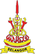
The coat of arms or state emblem of Selangor. Designed in the reign of Sultan Abdul Samad, the yellow and red symbolises flesh and blood. The crescent and star represent Islam, the State religion. The red spear in the centre with a short kris to the right and a long kris to the left are part of the State regalia. The jawi script writing expresses the State motto meaning "Under the protection of Allah". Below the motto is the broad belt or sash worn at the waist by warriors in the past.
Map of Malaysia with Selangor highlighted
(c) Mysid z angielskojęzycznej Wikipedii, CC-BY-SA-3.0
Flag of the Malaysian state Selangor.


