Sevenoaks (dystrykt)
| ||
| District | ||
| Państwo | ||
|---|---|---|
| Kraj | ||
| Hrabstwo | Kent | |
| Siedziba | Sevenoaks | |
| Powierzchnia | 370,44 km² | |
| Populacja (2011) • liczba ludności | 114 893[1] | |
| • gęstość | 310 os./km² | |
| Położenie na mapie hrabstwa Kent Contains Ordnance Survey data © Crown copyright and database right, CC BY-SA 3.0 | ||
| Strona internetowa | ||
| Portal | ||
Sevenoaks District – dystrykt w Anglii, w zachodniej części hrabstwa Kent. Centrum administracyjne dystryktu znajduje się w Sevenoaks.
Dystrykt ma powierzchnię 370,34 km2, od północy i od wschodu graniczy odpowiednio z dystryktami Dartford, Gravesham, Tonbridge and Malling i Tunbridge Wells w hrabstwie Kent, od zachodu na krótkim odcinku z London Borough of Bexley a także z London Borough of Bromley oraz z dystryktem Tandridge w hrabstwie Surrey, zaś od południa z dystryktem Wealden w hrabstwie East Sussex. Zamieszkuje go 114 893 osób.
Podział administracyjny
Dystrykt obejmuje cztery miasta Edenbridge, Sevenoaks, Swanley i Westerham oraz 26 civil parish:
|
Dystrykt dzieli się na 26 okręgów wyborczych[2]:
|
|
Demografia
W 2011 roku dystrykt Sevenoaks miał 114 893 mieszkańców. Zgodnie ze spisem powszechnym z 2011 roku dystrykt zamieszkiwało 480 osób urodzonych w Polsce[3].
Podział mieszkańców według grup etnicznych na podstawie spisu powszechnego z 2011 roku[4]:
|
|
Podział mieszkańców według wyznania na podstawie spisu powszechnego z 2011 roku[5]:
- Chrześcijaństwo - 65,4%
- Islam – 0,5%
- Hinduizm – 0,3%
- Judaizm – 0,2%
- Buddyzm – 0,3%
- Sikhizm – 0,2%
- Pozostałe religie – 0,3%
- Bez religii – 25,2%
- Nie podana religia – 7,6%
Transport i komunikacja
Na terenie dystryktu znajdują się następujące stacje kolejowe:
|
|
Przez dystrykt przechodzą autostrady M25, M26 i M20, a także droga A2 łącząca Dover z centrum Londynu.
Turystyka
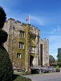
- zamek Hever
- zamek Chiddingstone[6]
- Knole House - wybudowany jako pałac arcybiskupa Canterbury[7]
- Chartwell House – rezydencja Winstona Churchilla[8]
- Ightham Mote pochodzący z XIV wieku[9]
- zamek Lullingstone[10]
- tor wyścigowy Brands Hatch
- Shoreham Aircraft Museum[11]
- Lullingstone Roman Villa[12]
- Penhurst Place - wybudowany w XIV wieku[13]
Inne miejscowości
Ash, Badgers Mount, Bough Beech, Brasted, Chevening, Chiddingstone, Chiddingstone Causeway, Chipstead, Cowden, Crockenhill, Crockham Hill, Dryhill, Dunton Green, Eynsford, Farningham, Fawkham, Fawkham Green, Fordcombe, Four Elms, Halstead, Hartley, Hever, Hextable, Hodsoll Street, Horton Kirby, Ide Hill, Kemsing, Knatts Valley, Knockholt, Leigh, Lullingstone, Markbeech, New Ash Green, Otford, Penshurst, Ridley, Riverhead, Seal Chart, Seal, Sevenoaks Weald, Shoreham, South Darenth, Sundridge, Swanley, Underriver, Well Hill, West Kingsdown, Westerham.
Przypisy
- ↑ „ons.gov.uk – 2011 Census: KS102EW Age structure, local authorities in England and Wales”
- ↑ „ sevenoaks.gov.uk – Your Councillors by Ward”
- ↑ „ons.gov.uk – 2011 Census: KS204EW Country of birth, local authorities in England and Wales”
- ↑ „ons.gov.uk – 2011 Census: KS201EW Ethnic group, local authorities in England and Wales”
- ↑ „ons.gov.uk – 2011 Census: KS209EW Religion, local authorities in England and Wales”
- ↑ „chiddingstonecastle.org.uk - Official website”
- ↑ „nationaltrust.org.uk - Knole”
- ↑ „nationaltrust.org.uk – Chartwell”
- ↑ „nationaltrust.org.uk - Ightham Mote”
- ↑ „lullingstonecastle.co.uk - Official website”
- ↑ „shoreham-aircraft-museum.co.uk - Official website”
- ↑ „english-heritage.org.uk - Lullingstone Roman Villa”
- ↑ „penshurstplace.com - Official website”
Media użyte na tej stronie
Flag of England. Saint George's cross (a red cross on a white background), used as the Flag of England, the Italian city of Genoa and various other places.
Autor: Russell Trow from London, UK, Licencja: CC BY 2.0
SEAT Leon Cupra championship opening corner
Contains Ordnance Survey data © Crown copyright and database right, CC BY-SA 3.0
Equirectangular map projection on WGS 84 datum, with N/S stretched 160%
Autor: Nigel Lamb, Licencja: CC BY 2.0
Front entrance to Hever Castle in Kent, famous as the childhood home of Anne Boleyn.
Autor: Diliff, Licencja: CC BY-SA 3.0
Knole as viewed from the grounds. Taken as a 5 segment panorama with a Canon 5D and 70-200mm f/2.8L lens.
Autor: Michael Coppins, Licencja: CC BY-SA 4.0
This is a photo of listed building number
(c) John Darch, CC BY-SA 2.0
Chartwell House - front elevation.


