Shepperton
(c) steve, CC BY-SA 2.0 | |
| Państwo | |
|---|---|
| Kraj | |
| Hrabstwo | |
| Dystrykt | |
| Populacja • liczba ludności |
|
| Nr kierunkowy | 01932 |
| Kod pocztowy | TW17 |
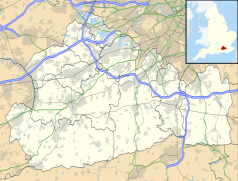
Położenie na mapie Surrey Contains Ordnance Survey data © Crown copyright and database right, CC BY-SA 3.0 | |
Położenie na mapie Wielkiej Brytanii (c) Karte: NordNordWest, Lizenz: Creative Commons by-sa-3.0 de | |
| Portal | |
Shepperton – miasto w Anglii, w hrabstwie Surrey, w dystrykcie Spelthorne. Leży 26 km na południowy zachód od centrum Londynu[2]. Miasto liczy 10 796 mieszkańców[1].
W mieście znajduje się wytwórnia filmów Shepperton Studios, w której powstały m.in.: Tajemnicza wyspa (film 1961), Superman (film), Gandhi (film), Notting Hill (film), Cztery wesela i pogrzeb, Bridget Jones: W pogoni za rozumem, Harry Potter i więzień Azkabanu (film), Szybcy i wściekli 6, Mamma Mia: Here We Go Again!.
Galeria
- (c) Arrived at Shepperton by Row17, CC BY-SA 2.0
Tablica z nazwą
- (c) Shepperton Station by Row17, CC BY-SA 2.0
Stacja kolejowa
- (c) Colin Smith, CC BY-SA 2.0
Budynek z listy zabytków
Przypisy
- ↑ a b Population figures (PDF). [dostęp 2005-10-29]. [zarchiwizowane z tego adresu (2005-10-29)].
- ↑ Shepperton na mapie. getamap.ordnancesurvey.co.uk. [dostęp 2010-11-27]. (ang.).
Media użyte na tej stronie
(c) Karte: NordNordWest, Lizenz: Creative Commons by-sa-3.0 de
Location map of the United Kingdom
Flag of England. Saint George's cross (a red cross on a white background), used as the Flag of England, the Italian city of Genoa and various other places.
(c) Colin Smith, CC BY-SA 2.0
The Little Cottage. Second building on north side of Chertsey Road that is listed at Grade II in Old Shepperton.
(c) Arrived at Shepperton by Row17, CC BY-SA 2.0
Arrived at Shepperton
Contains Ordnance Survey data © Crown copyright and database right, CC BY-SA 3.0
Map of Surrey, UK with the following information shown:
- Administrative borders
- Coastline, lakes and rivers
- Roads and railways
- Urban areas
Equirectangular map projection on WGS 84 datum, with N/S stretched 160%
Geographic limits:
- West: 0.87W
- East: 0.08E
- North: 51.50N
- South: 51.05N
(c) Shepperton Station by Row17, CC BY-SA 2.0
Shepperton Station
(c) steve, CC BY-SA 2.0
Church Square Shepperton. This square contains a Church and several pubs and houses in an old square near the Thames


