Shreveport
(c) Michael Barera, CC BY-SA 4.0 | |||||
| |||||
| Państwo | |||||
|---|---|---|---|---|---|
| Stan | |||||
| Burmistrz | Adrian Perkins | ||||
| Powierzchnia | 305,1 km² | ||||
| Populacja (2004) • liczba ludności • gęstość |
| ||||
| Nr kierunkowy | 318 | ||||
| Strefa czasowa | |||||
| Strona internetowa | |||||
Shreveport – miasto w Stanach Zjednoczonych, w stanie Luizjana, w parafii Bossier, nad rzeką Red River. 198,6 tys. mieszkańców (1990).
Powstało w roku 1835, wówczas nazywało się Shreve's. W latach 1863-1865 było stolicą stanu i jednym z ostatnich bastionów oporu konfederatów w Luizjanie.
Miasto było ośrodkiem handlu bawełną. Prawa miejskie otrzymało w 1878 roku. Gwałtowny rozwój od roku 1906, kiedy odkryto ropę naftową nad jeziorem Caddo Lake.
Oprócz przemysłu petrochemicznego (rafineria), dominuje przemysł maszynowy, metalowy, spożywczy, drzewny, chemiczny i szklarski.
Media użyte na tej stronie
Autor: Uwe Dedering, Licencja: CC BY-SA 3.0
Location map of the USA (without Hawaii and Alaska).
EquiDistantConicProjection:
Central parallel:
* N: 37.0° N
Central meridian:
* E: 96.0° W
Standard parallels:
* 1: 32.0° N
* 2: 42.0° N
Made with Natural Earth. Free vector and raster map data @ naturalearthdata.com.
Formulas for x and y:
x = 50.0 + 124.03149777329222 * ((1.9694462586094064-({{{2}}}* pi / 180))
      * sin(0.6010514667026994 * ({{{3}}} + 96) * pi / 180))
y = 50.0 + 1.6155950752393982 * 124.03149777329222 * 0.02613325650382181
      - 1.6155950752393982  * 124.03149777329222 *
     (1.3236744353715044  - (1.9694462586094064-({{{2}}}* pi / 180))
      * cos(0.6010514667026994 * ({{{3}}} + 96) * pi / 180))
The flag of Navassa Island is simply the United States flag. It does not have a "local" flag or "unofficial" flag; it is an uninhabited island. The version with a profile view was based on Flags of the World and as a fictional design has no status warranting a place on any Wiki. It was made up by a random person with no connection to the island, it has never flown on the island, and it has never received any sort of recognition or validation by any authority. The person quoted on that page has no authority to bestow a flag, "unofficial" or otherwise, on the island.
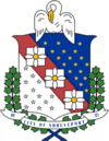
The coat of arms of Shreveport from the flag of Shreveport.
(c) Michael Barera, CC BY-SA 4.0
A view of the Shreveport skyline from Bossier City, Louisiana (United States).
Autor: Alexrk2, Licencja: CC BY 3.0
Ta mapa została stworzona za pomocą GeoTools.
Flag of Shreveport, Lousiana


