Siengilej
| |||
 | |||
| |||
| Państwo | |||
| Obwód | |||
| Populacja (2010) • liczba ludności | 6958[1] | ||
| Nr kierunkowy | 84233 | ||
| Kod pocztowy | 433380 | ||
| 53°58′N 48°48′E/53,966667 48,800000 | |||
| Strona internetowa | |||
| Portal | |||
Siengilej – miasto w Rosji, w obwodzie uljanowskim. W 2010 roku liczyło 6958 mieszkańców. Znajduje się tu zarząd Parku Narodowego „Siengilejewskije gory”[2].
Przypisy
- ↑ Dane ze spisu ludności w 2010 r.
- ↑ Национальный парк "Сенгилеевские горы"" [dostęp 2021-08-13] (ros.).
Linki zewnętrzne
- Siengilej, [w:] Słownik geograficzny Królestwa Polskiego, t. X: Rukszenice – Sochaczew, Warszawa 1889, s. 557.
Media użyte na tej stronie
Autor: Uwe Dedering, Licencja: CC BY-SA 3.0
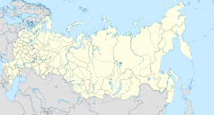
Location map of Russia.
EquiDistantConicProjection : Central parallel :
* N: 54.0° N
Central meridian :
* E: 100.0° E
Standard parallels:
* 1: 49.0° N
* 2: 59.0° N
Made with Natural Earth. Free vector and raster map data @ naturalearthdata.com.
Because the southern Kuril islands are claimed by Russia and Japan, they are shown as disputed. For more information about this see: en:Kuril Islands dispute. These islands are since 1945 under the jurisdiction of the Russian Federation.
Флаг Ульяновской области, согласно, закона Ульяновской области от 26.12.2013 № 248–ЗО «О флаге Ульяновской области»
Autor: Nzeemin, Licencja: CC BY-SA 2.0
Administrative map of Ulyanovsk Oblast, Russia.
- Projection: Mercator
- Geographic limits of the map:
- N: 54.92° N
- S: 52.50° N
- W: 45.78° E
- E: 50.28° E
- Tools used: GMT, Inkscape


