Silbertal
 | |||
| |||
| Państwo | |||
|---|---|---|---|
| Kraj związkowy | |||
| Powiat | |||
| Powierzchnia | 88,65 km² | ||
| Wysokość | 889 m n.p.m. | ||
| Populacja (1 stycznia 2015) • liczba ludności |
| ||
| • gęstość | 9 os./km² | ||
| Numer kierunkowy | 05556 | ||
| Kod pocztowy | 6782 | ||
| Tablice rejestracyjne | BZ | ||
| Strona internetowa | |||
Silbertal – gmina w Austrii, w kraju związkowym Vorarlberg, w powiecie Bludenz. Według Austriackiego Urzędu Statystycznego liczyła 839 mieszkańców (1 stycznia 2015)[1].
Zobacz też
- Silberthal
Przypisy
Media użyte na tej stronie
Autor: Lencer, Licencja: CC BY-SA 3.0
Location map of Austria
Equirectangular projection, N/S stretching 150 %. Geographic limits of the map:
- N: 49.2° N
- S: 46.3° N
- W: 9.4° E
- E: 17.2° E
Autor: Schaer Chris from Brittnau, Schweiz, Licencja: CC BY-SA 2.0
Blick auf Silbertal in Österreich
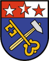
Silbertal, Vorarlberg: In blauem Schild ein goldener Schlüssel gekreuzt mit einem silbernen Hammer. Das Schildhaupt ist von Rot und Weiß gespalten und mit drei fünfzackigen Sternen in wechselnden Farben belegt. (Verleihung: 12. Mai 1964)
Autor: Rosso Robot, Licencja: CC BY-SA 3.0
Location map of Vorarlberg
Equirectangular projection. Geographic limits of the map:
- N: 47.62 N
- S: 46.82 N
- W: 9.45 E
- E: 10.3 E


