Silloth
(c) Humphrey Bolton, CC BY-SA 2.0 | |
| Państwo | |
|---|---|
| Kraj | |
| Hrabstwo | Kumbria |
| Dystrykt | Allerdale |
| Populacja (2011) • liczba ludności | 2906 (civil parish) |
| Nr kierunkowy | 016973 |
| Kod pocztowy | CA7 |
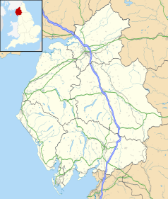
Położenie na mapie Kumbrii Contains Ordnance Survey data © Crown copyright and database right, CC BY-SA 3.0 | |
Położenie na mapie Wielkiej Brytanii (c) Karte: NordNordWest, Lizenz: Creative Commons by-sa-3.0 de | |
| Strona internetowa | |
| Portal | |
Silloth (czasem także: Silloth-on-Solway)[1] – miasto portowe oraz civil parish w dystrykcie Allerdale, w Kumbrii, w Anglii. Leży 29 km na zachód od miasta Carlisle i 432 km na północny zachód od Londynu[2]. W 2011 roku civil parish liczyła 2906 mieszkańców[3].
Przypisy
- ↑ Ordnance Survey linked data
- ↑ Silloth na mapie (ang.). getamap.ordnancesurvey.co.uk. [dostęp 2010-11-27].
- ↑ Neighbourhood Statistics. [dostęp 2015-10-29]. [zarchiwizowane z tego adresu (2016-03-05)].
Media użyte na tej stronie
(c) Karte: NordNordWest, Lizenz: Creative Commons by-sa-3.0 de
Location map of the United Kingdom
Flag of England. Saint George's cross (a red cross on a white background), used as the Flag of England, the Italian city of Genoa and various other places.
Contains Ordnance Survey data © Crown copyright and database right, CC BY-SA 3.0
Map of Cumbria, UK with the following information shown:
- Administrative borders
- Coastline, lakes and rivers
- Roads and railways
- Urban areas
Equirectangular map projection on WGS 84 datum, with N/S stretched 170%
Geographic limits:
- West: 3.80W
- East: 2.10W
- North: 55.20N
- South: 54.02N
(c) Humphrey Bolton, CC BY-SA 2.0
Original description:
Criffel Street, Silloth
Silloth was developed as a fashionable spa town, but was not very successful, but is now attractive with its bright colour-washed buildings. It was planned by Messrs Hay of Liverpool as a grid of wide tree-lined streets. The main street is Criffel Street, named after the prominent mountain over the Solway Firth. On the seaward side of Criffel Street there is a large green, with pine trees, between the town and the well built Promenade, which gives good views across the Solway. The granite setts are now 'heritage' and a tourist attraction.


