Sluis
 | |||||
| Państwo | |||||
|---|---|---|---|---|---|
| Prowincja | |||||
| Burmistrz | Annemiek Jetten (2014)[1] | ||||
| Populacja • liczba ludności |
| ||||
| Nr kierunkowy | 0117 | ||||
| Kod pocztowy | 4500–4519 | ||||
| Strona internetowa | |||||
Sluis – miasto i gmina w Holandii, w regionie Zelandia. Gmina powstała w 2003 r. w wyniku połączenia dwóch gmin: Oostburg oraz Sluis-Aardenburg i liczy 23 902 mieszkańców[2].
Miejscowości
Składa się z dwudziestu miejscowości: Aardenburg, Breskens, Cadzand, Draaibrug, Eede, Groede, Heille, Hoofdplaat, IJzendijke, Nieuwvliet, Oostburg, Retranchement, Schoondijke, Sint Anna ter Muiden, Sint Kruis, Sluis, Terhofstede, Waterlandkerkje, Zuidzande oraz Zwindorp.
Miasto Sluis
Miasto Sluis uzyskało prawa miejskie w 1290 r. i liczy 2376 mieszkańców[2]. Restauracja Oud Sluis jest jedną z dwóch restauracji w kraju, które posiadają trzy gwiazdki Michelin.
Przypisy
- ↑ gemeentesluis.nl: College B&W (niderl.). [dostęp 2014-07-10]. [zarchiwizowane z tego adresu (2013-12-16)].
- ↑ a b c Bevolkingscijfers (niderl.). Gemeente Sluis, 08 stycznia 2014. [dostęp 2014-04-26]. [zarchiwizowane z tego adresu (2014-04-08)].
Media użyte na tej stronie
Autor: PetrusSilesius, Licencja: CC BY-SA 2.0 de
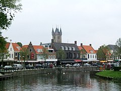
View from the channel to the city and Belfort of Sluis.
Autor: Erik Frohne, Licencja: CC BY-SA 3.0
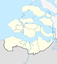
Location map of province Zeeland in the Netherlands
Equirectangular projection, N/S stretching 160 %. Geographic limits of the map:
- N: 51.80° N
- S: 51.10° N
- W: 3.30° E
- E: 4.30° E
Coat of arms of the Dutch municipality of Sluis.
Flag of the Dutch municipality of Sluis


